


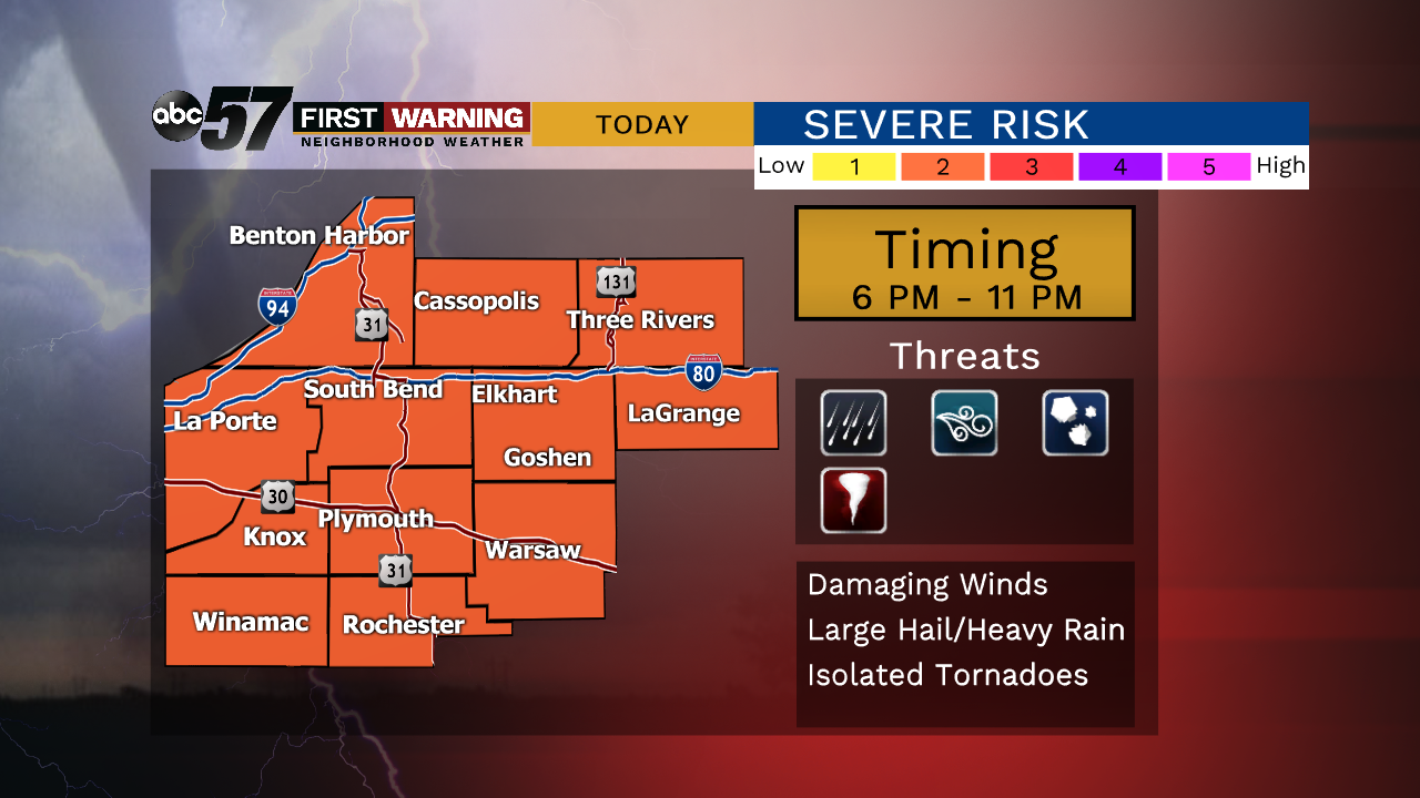
Clouds increase as we head through today with a chance of isolated storms this afternoon. The main line of storms arrives this evening after 6 pm and it’s that line that could be severe. The main threats are damaging winds and hail but an isolated tornado cannot be ruled out. Make sure you’re staying weather aware! One big factor on our chance of severe weather today will be a dying storm complex passing mainly to our north. If it builds any further south towards our area, our risk will lessen.
Stay up-to-date with our ABC 57 Weather App.
Once the cold front swings through, we are left with very Fall-like conditions through the remainder of the week. Wind will be gusty for Wednesday, creating high waves and dangerous swimming conditions along Lake Michigan. There is even a slight chance of waterspouts early in the day.
Today: Increasing clouds and breezy, PM storms, severe risk, high of 84.
Tonight: Storms possible early, low of 62.
Wednesday: Partly to mostly sunny, windy, high of 68.
Thursday: Mostly sunny, high of 72.