Severe weather threat: damaging winds, brief tornado possible
Posted: Aug 14, 2019 11:06 AM EDT
The Wednesday morning update from the Storm Prediction Center introduced areas along and south of U.S. 6 in a "marginal risk" for severe thunderstorms during the afternoon and evening.
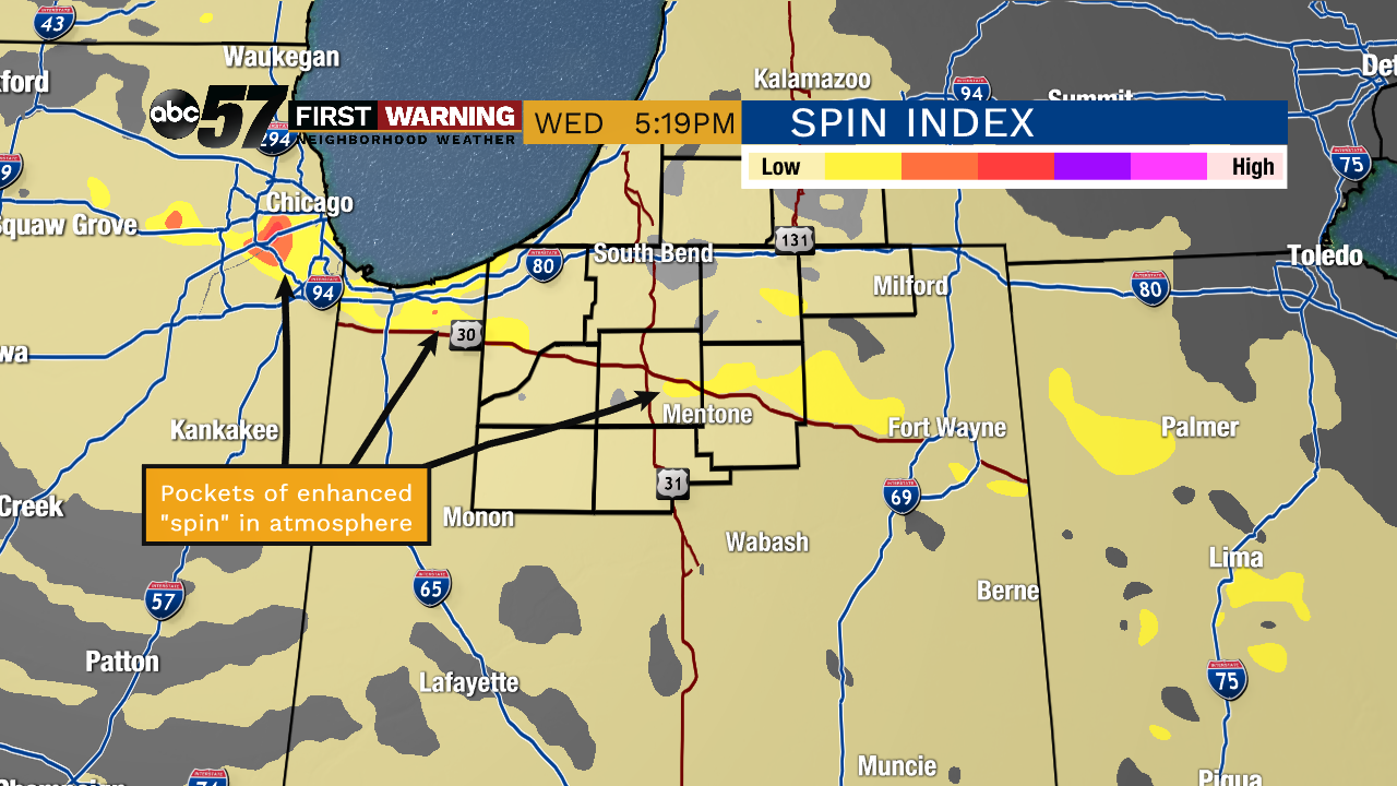
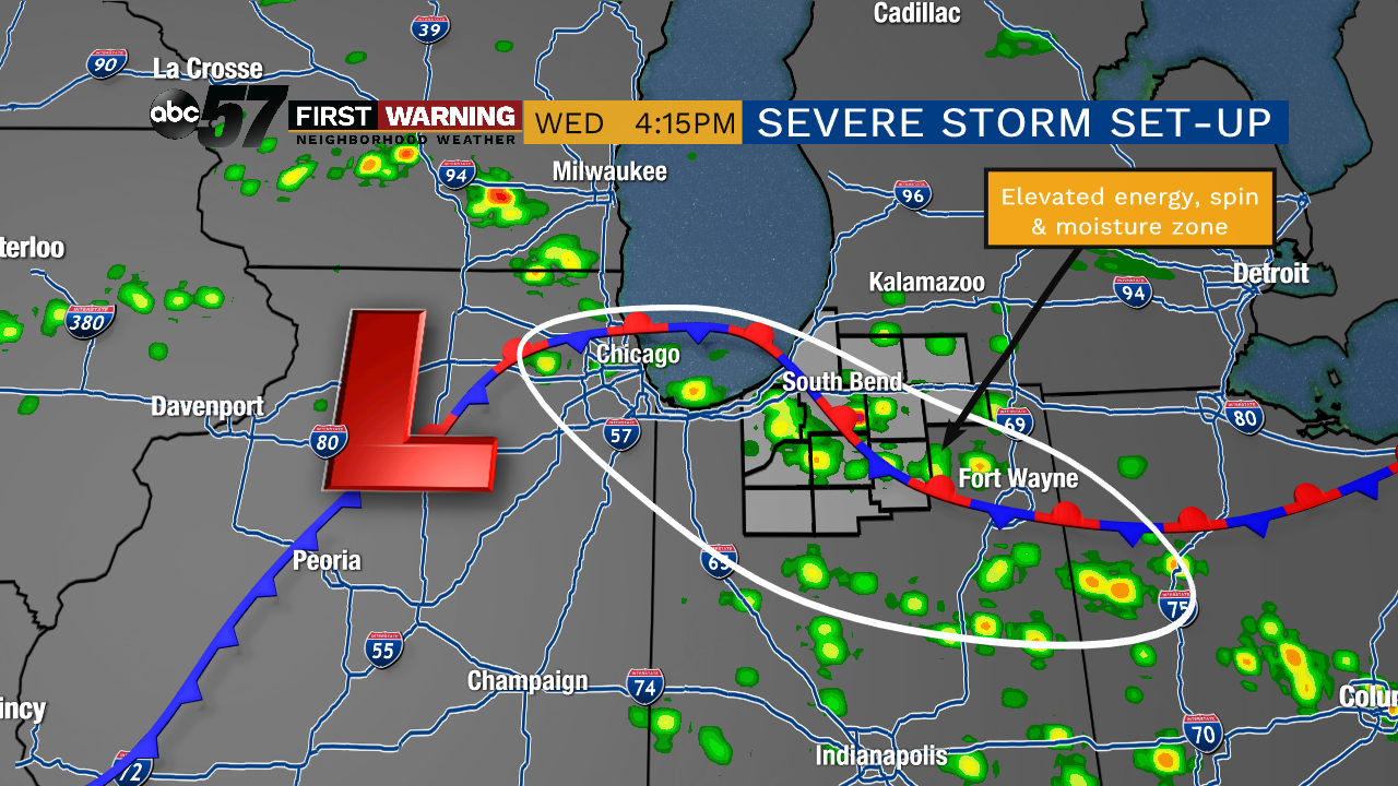
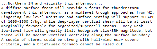
The threat is deemed "marginal" -- or low -- according to the SPC. However, similar set-ups in the past have yielded a few severe thunderstorms. Any storms that do become strong to severe will be capable of strong to locally damaging wind gusts, small hail and funnel clouds/brief tornadoes.
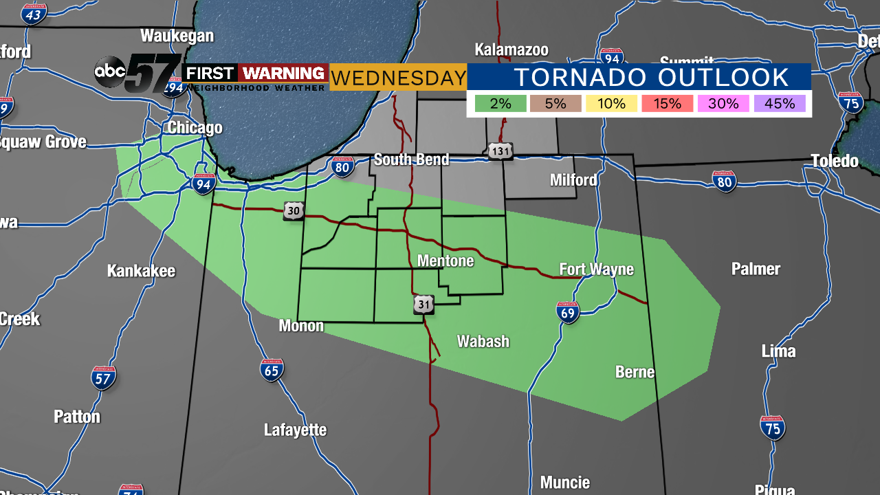 Wednesday's tornado risk.
It's also important to remember that while most of us will likely not see severe weather, it is possible just about everywhere south of the Toll Road into the evening.
