
-
1:06

Marshall County Humane Society reschedules Dog Egg Hunt
-
2:01

Martin Luther King Dream Center hosts MLK March in South Bend
-
1:54

South Bend Cubs opener postponed by weather, but fans still find...
-
2:01

Sights and sounds from South Bend Cubs Opening Day
-
1:32

NIPSCO ’flatly rejected’ further negotiations, USW workers...
-
3:36

The art of groundskeeping at Four Winds Field
-
3:32

The history behind America’s only ballpark synagogue turned...
-
1:59

South Bend opens season against Quad Cities in familiar Midwest...
-
4:21

South Bend Cubs owner discusses $48M stadium expansion, changes...
-
3:19

A look into the new South Bend Cubs 2026 roster
-
5:17

Expansion goes beyond Four Winds Field, new restaurants, bars,...
-
6:18

What’s new this season? South Bend Cubs unveil major improvements...

Update 10 PM -- After strong storms, heavy rain continues overnight. Storms could be loud but are unlikely to be severe. Be aware of flooded roads or downed limbs in the morning.
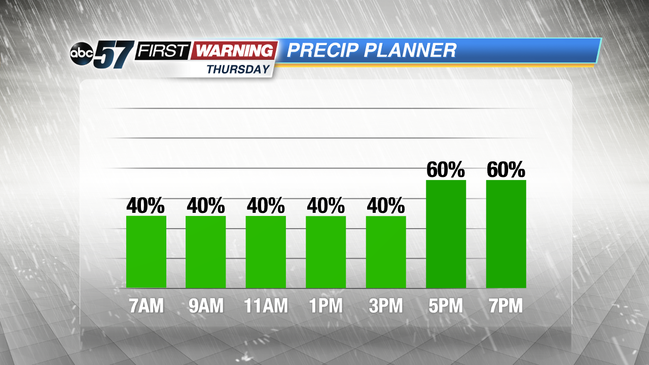
The chance of showers and thunderstorms increases overnight through Thursday morning. A few cells could produce strong wind gusts or hail.
Showers and thunderstorms are likely through Thursday and into Friday morning. This is much needed rain that could bring more than an inch in total with higher amounts under thunder cells. The forecast stays muggy through Friday morning, before a front clears skies and drops the humidity Friday afternoon. The weekend looks mostly fair with a small chance of rain Sunday.
Tonight: Chance of showers and storms, low of 64.
Thursday: Showers and thunderstorms likely, high of 76.
Friday: Showers likely through noon, high of 70.
Saturday: Sunny, high of 70.