


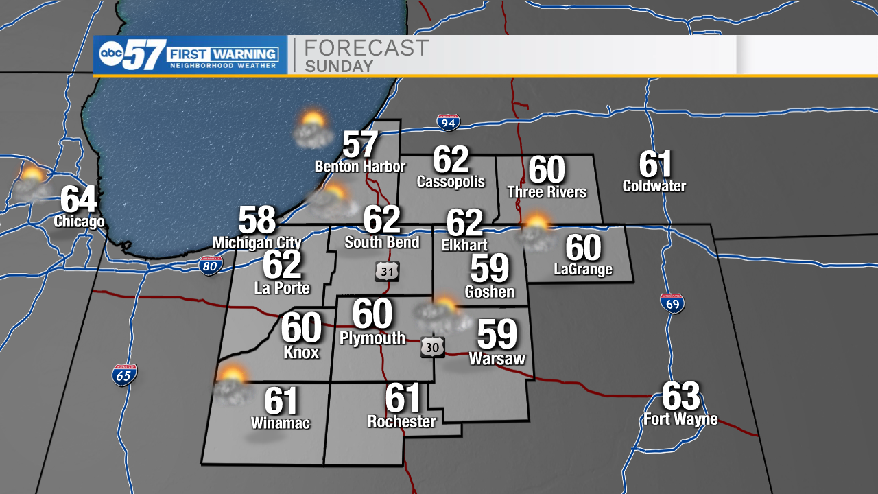
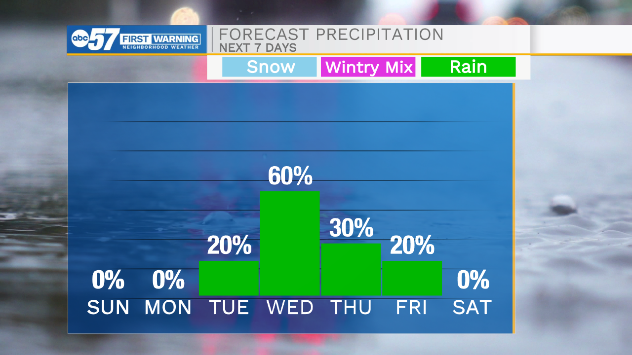
This evening, more isolated rain showers will develop impacting us here in Michiana. Finally, by early to mid-morning tomorrow showers will clear out then a little sunshine will return to the forecast. Highs tomorrow afternoon will top out in the lower 60s. Monday afternoon expect mostly sunny skies with high temperatures in the mid 60s. Rain chances return to the forecast Tuesday evening, then turn scattered in Wednesday. Rain will remain in the forecast through Thursday, but then we begin to clear things out again heading into the end of the week. High temperatures this week will briefly hit the 70s Tuesday and Wednesday, then drop back into the 60s for Thursday and Friday.
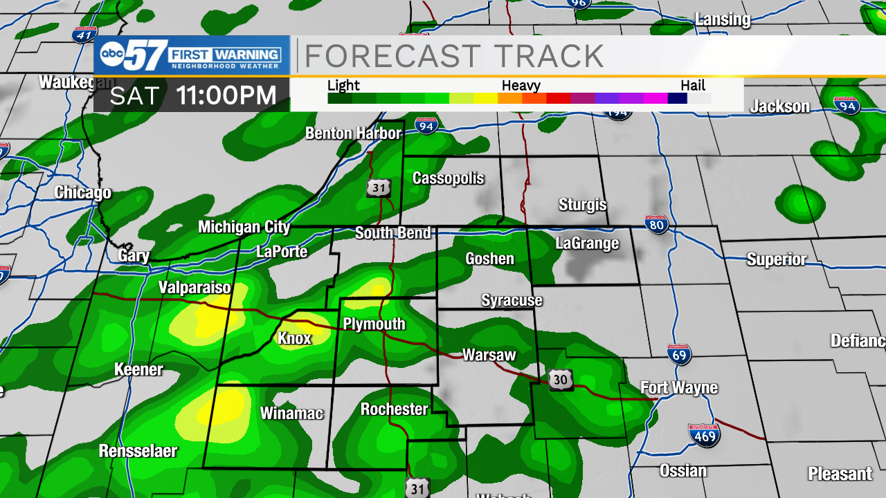
Tonight: Isolated showers. Low 50.
Tomorrow: Mostly/partly cloudy. High 66.
Monday: Mostly sunny. High 65.
Tuesday: Partly cloudy/PM showers. High 72.