Slick spots possible Tuesday morning, watching the weekend snow

-
1:48

Scattered showers this evening, Much cooler overnight
-
1:50

Showers and storms this afternoon
-
0:20

One person injured in shooting
-
0:36

Eddies Circuit Robotics holds competition Saturday
-
0:32

21st annual Nappanee Model Train Show
-
0:38

Local boys basketball team headed to IHSAA state finals
-
3:49

Midwest Meowfest brings kitten advocacy to attendees, new homes...
-
1:52

Mild tonight, showers tomorrow
-
1:43

Pleasant to start the weekend
-
3:06

Pulaski County weighs stricter solar rules amid resident concerns
-
0:40

Marian High School hosts World Down Syndrome Awareness Walk
-
2:33

South Bend leaders call for an end to gun violence

Light freezing drizzle or fog may develop overnight into early Tuesday leading to a glaze of ice and slick spots early Tuesday.
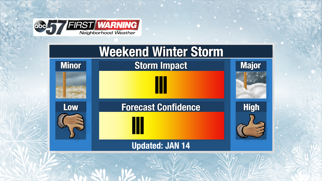
Cold and cloudy weather continues Tuesday and Wednesday with highs peaking just above freezing and the possibility of freezing fog or drizzle. A weak system will bring a chance of snow Thursday, followed by a lull Friday. The focus will be on a system that could bring widespread snow Saturday and lake effect Sunday. Snow looks likely but the finer details will become more clear later this week.
Tonight: Cloudy, patchy freezing fog / drizzle. Low of 22.
Tuesday: Cloudy, patchy freezing fog / drizzle. High of 34.
Wednesday: Mostly cloudy, patchy freezing fog / drizzle / snow. High of 34.
Thursday: Light snow showers, high of 32.