


With high temperatures in the 50s Wednesday, it was yet another day across Michiana that didn't feel much like winter.
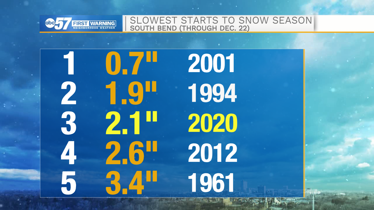
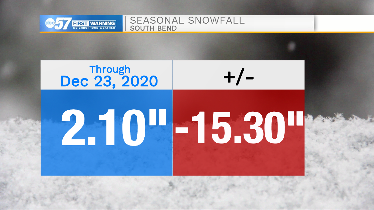
South Bend has recorded only 2.1 inches of snow since October, meaning we're in the midst of the third slowest start to the snow season on record.
South Bend's snowfall deficit has ballooned to more than a foot heading into the last week of December.
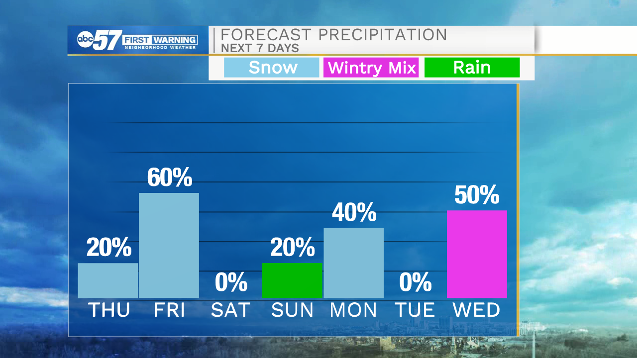
However, lake-effect snow could make a big dent in that deficit by this weekend. Our best chance of significant accumulating snow will be on Christmas morning.
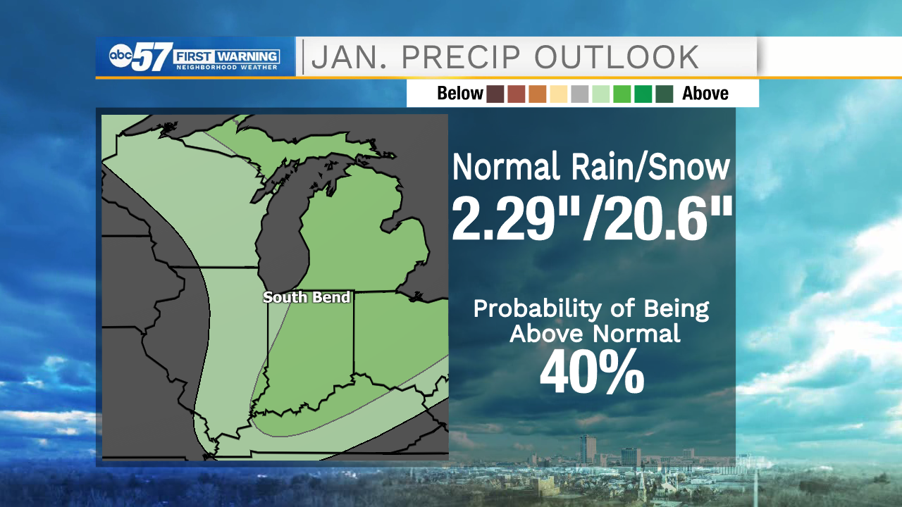
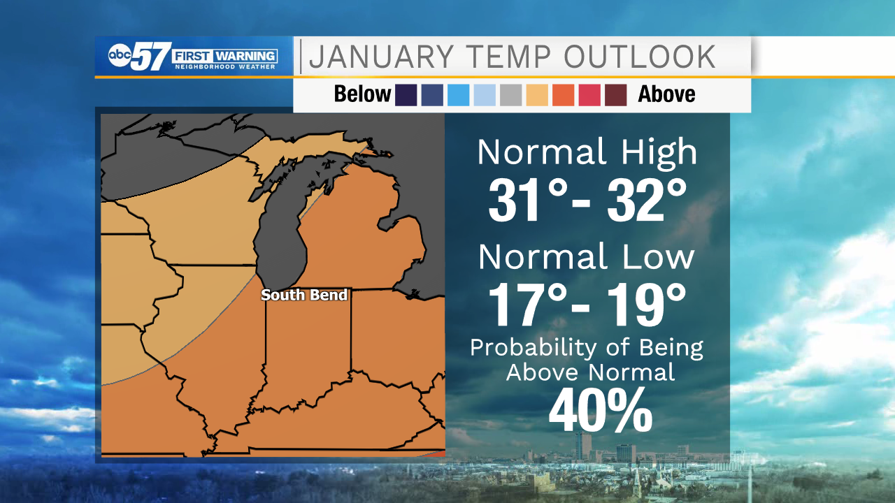
At this point, it looks like we'll have a similar slog to get snow in January as well. While above-normal precipitation is expected, temperatures may remain above normal as well, leading to additional days of mixed precipitation.
For now, our attention is focused on the potential for holiday snowfall that could make travel hazardous in some areas. Stay with ABC57 News on-air, online and on social media for the latest forecast updates and information.