Snow adds up tonight into Friday morning
By: Emily Kennedy
Posted: Apr 16, 2020 3:20 AM EDT

-
2:11

Snow wrapping up today, returns tomorrow
-
4:39

The Morris debuts its 2026-27 season lineup
-
2:25

Lake effect snow through this morning
-
0:25

City commission approves new downtown paid parking plan
-
3:41

Community shares concerns at board meeting over offensive language...
-
2:03

Staying safe around downed power lines
-
3:10

Former players share stories of Lou Holtz before his burial
-
3:02

Trust, Love, and Commitment: Lou’s Life Lessons
-
1:32

Notre Dame ready for funeral traffic
-
3:23

Notre Dame community says their final farewell to Coach Lou Holtz
-
5:58

Remembering Lou Holtz: Broadcasters reflect on Holtz’ role...
-
16:25

ESPN’s Rece Davis remembers the life and legacy of Lou Holtz

ABC 57 First Warning Neighborhood Weather
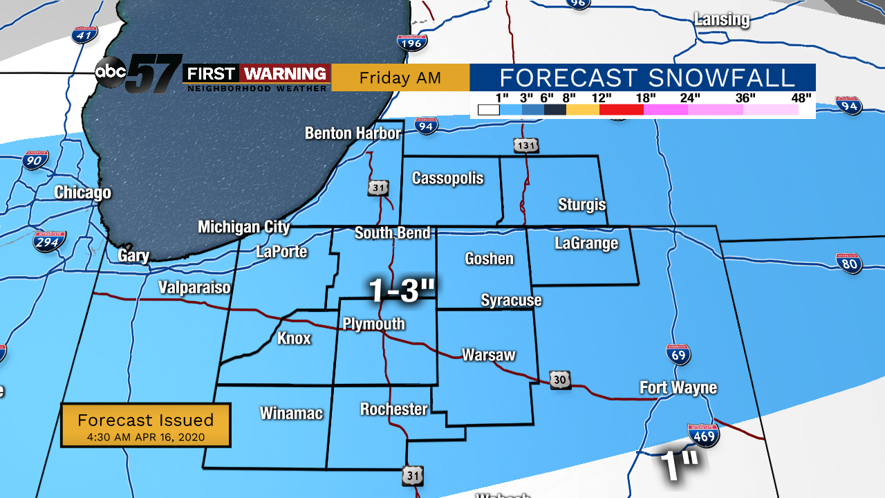
Thursday, April 16th, 2020
Daytime highs in the 40s stick around through the end of the work week. Another system moves in tonight, bringing light snow showers and a wintry mix into Friday morning. A quick 2-4" of snow is possible but most if not all of it will all melt by Friday evening. It finally warms and brightens back up over the weekend. Next week temperatures are much more Spring-like.
Today: Mostly sunny. High of 44.
Tonight: Snow showers late. Low 30.
Friday: AM snow/mix, mostly cloudy. High 40.
Saturday: Mostly to partly sunny. High of 53.
Sign up for the ABC 57 Newsletter