


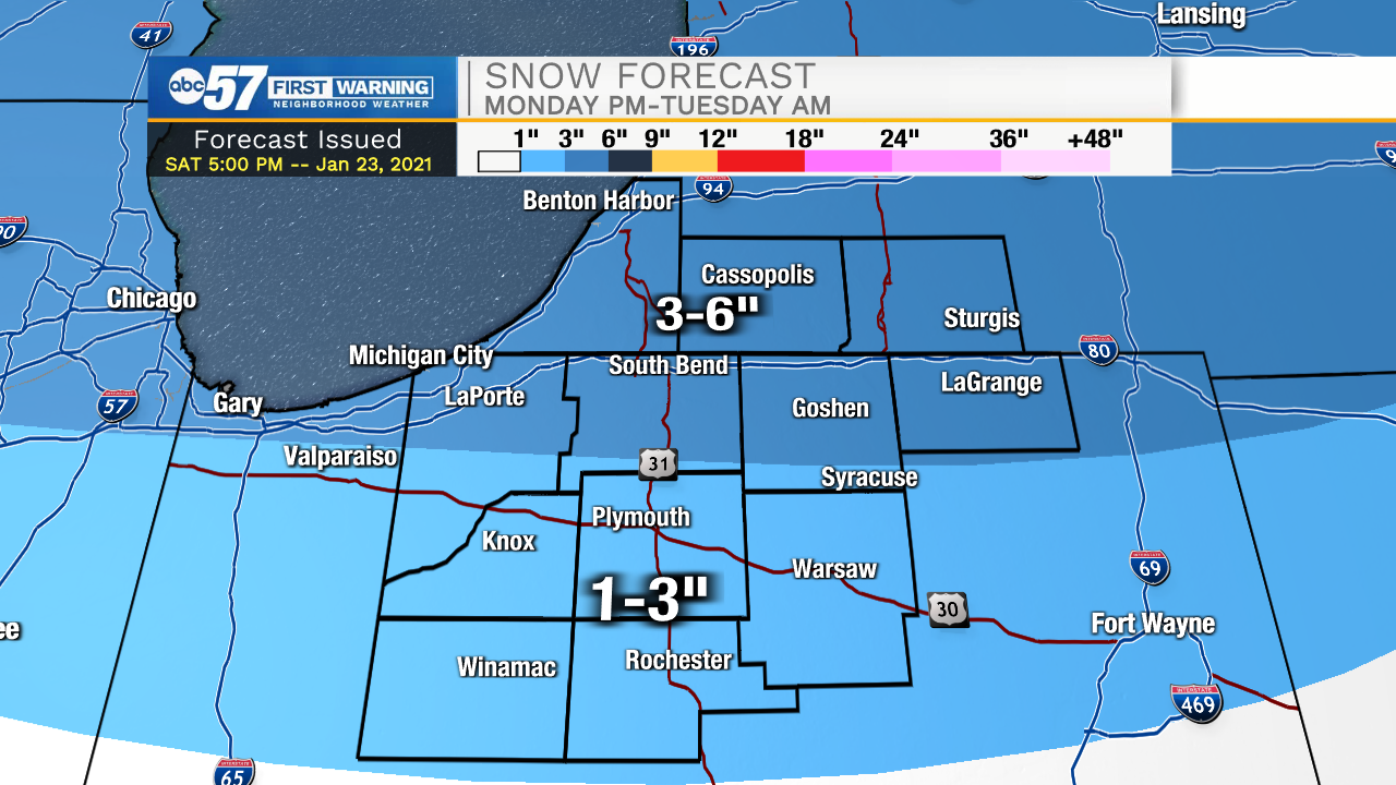
Tonight cloud cover will increase helping to keep temperatures in the mid 20s tomorrow morning. Scattered snow showers are likely throughout Michiana tomorrow morning and early afternoon. A light dusting is possible for portions of southern and central Michiana with a few isolated areas in southwest Michigan seeing closer to an inch. High temperatures tomorrow afternoon will top out in the lower 30s. Our next big system moves in Monday afternoon and will last till around lunchtime on Tuesday. Counties north of Highway 30 could see 3-6 inches of snow, while counties to the south will primarily deal with a wintry mix bringing totals closer to the 1-3” range. Snow showers could be heavy at times so visibilities will be reduced and slick spots will be likely. After the snow clears, cold temperatures will remain with lows Wednesday through Friday dropping into the teens and highs only toping out in the upper 20s.
Tonight: Snow showers. Low 24.
Tomorrow: AM Snow showers. High 32.
Monday: Widespread snow and wintry mix. High 34.
Tuesday: AM Snow showers. High 32.