


Today finally feels like winter, with cool temperatures and snow chances.
Snow starts first for our southern counties. It will generally move from south to north today. If you live in one of the southern most counties, you might see trace amounts of snow on the roads for your morning commute, but the northern half of Michiana might still have a dry commute. Even if there is just a dusting of snow on the road, there can still be slick spots, so you may need to plan to give yourself extra time to drive safely.
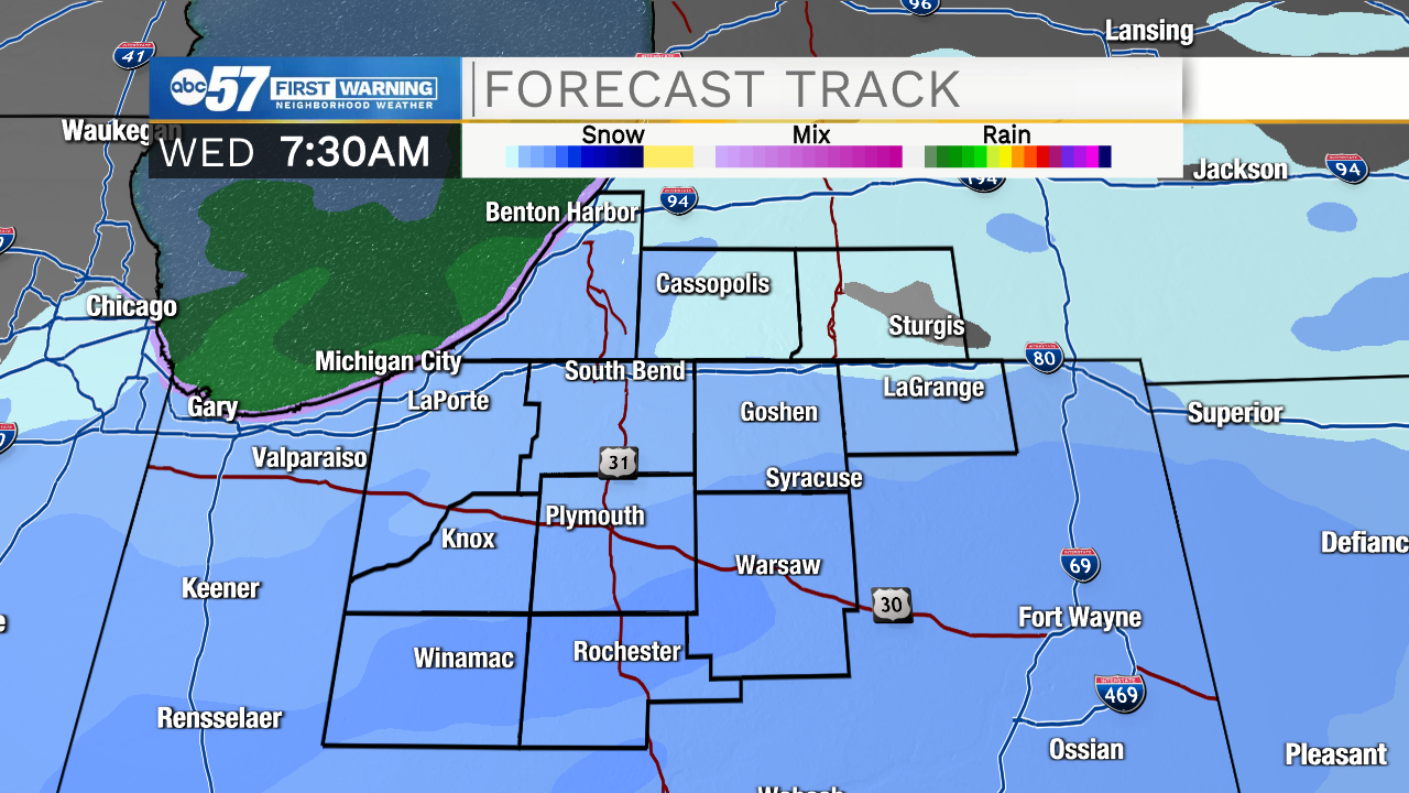
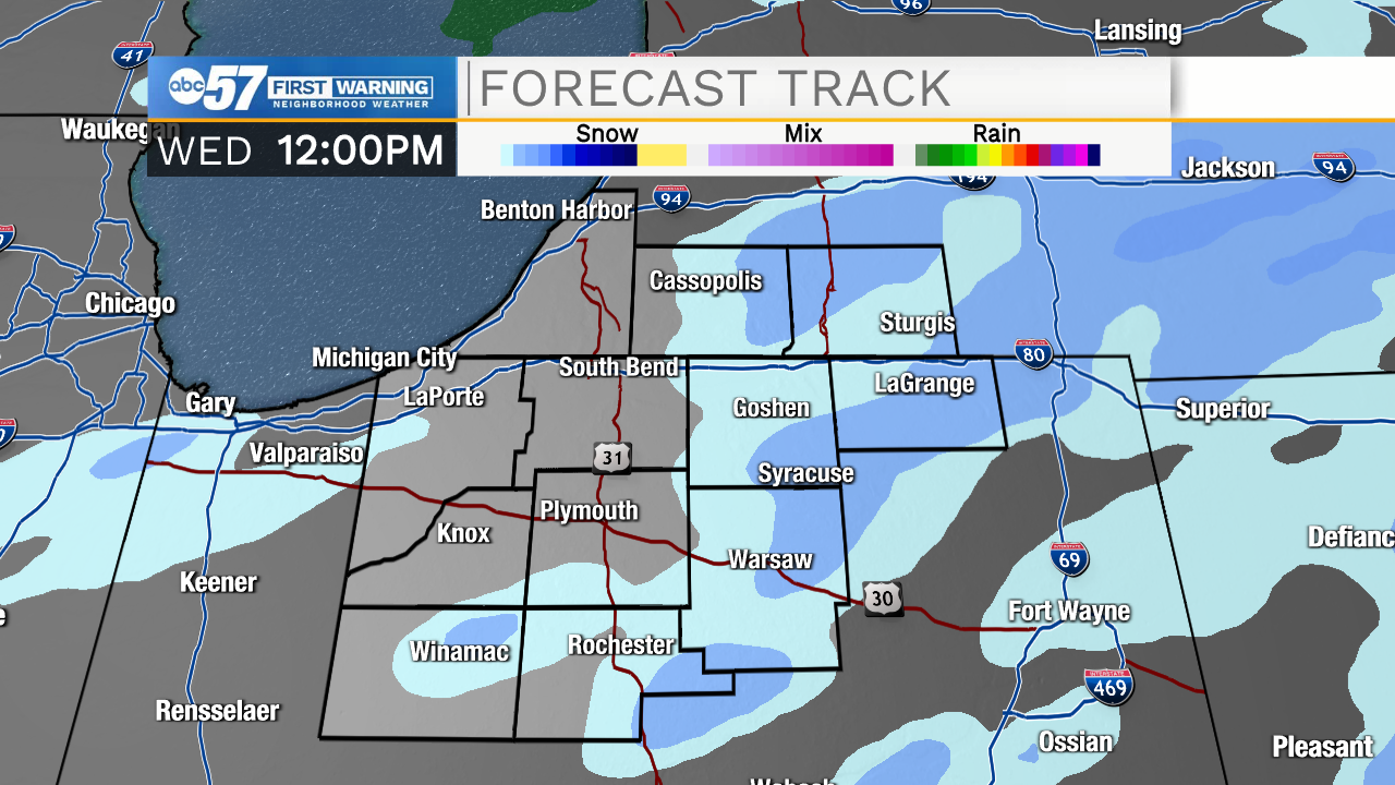
Light snow showers or flurries will continue off and on through the afternoon, then wrap up by this evening. It is looking like a relatively low impact event. Most of Michiana will see just trace amounts of snow, but it is possible to pick up slightly higher totals in our southeast counties.
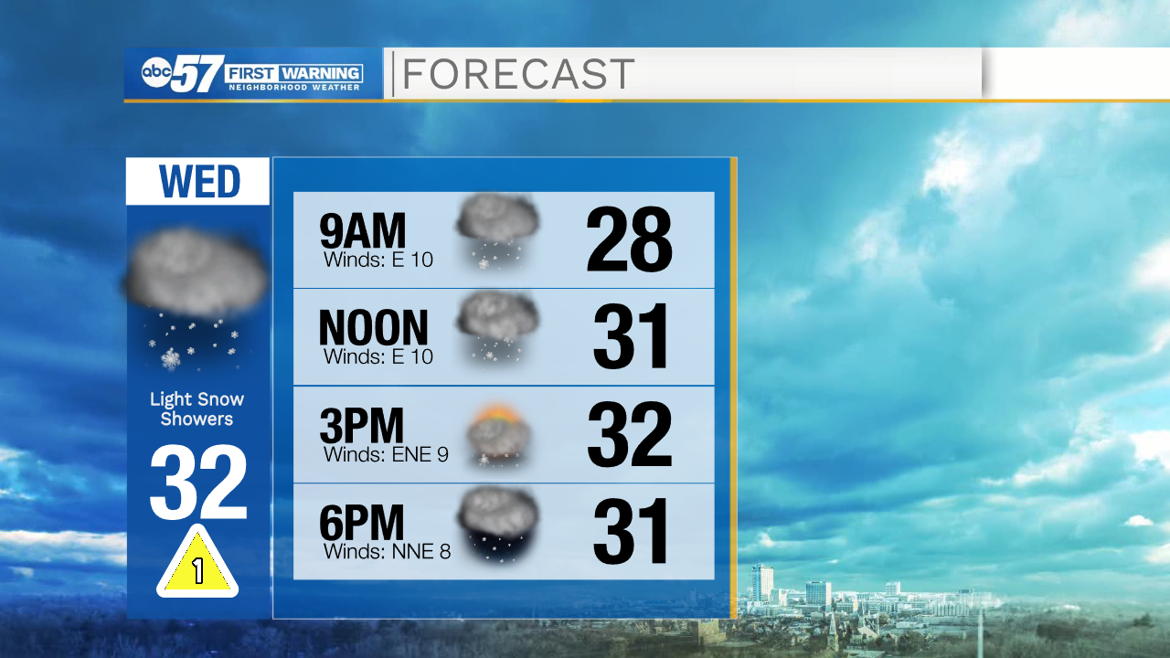
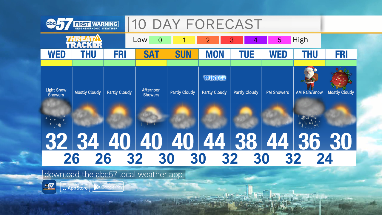
Temperatures start in the mid 20s this morning and warm to the low 30s. Overnight should be dry and cloudy with a low around 26.
Thursday and Friday it's back to the quiet, cloudy pattern, although we'll warm to the 40s starting Friday. The mild temperatures stick over the weekend. There is a chance for showers Saturday afternoon and evening. Sunday looks mostly dry. We'll keep the temperatures in the 40s to start next work week.
Wednesday: Mostly cloudy, flurries / snow showers. High 32.
Tonight: Cloudy. Low 26.
Thursday: Mostly cloudy. High 34.
Friday: Partly cloudy. High 40.