Snow to wintry mix and then turning bitter cold
![](/images/abclogo_gray.png?x)
-
2:30
Mishawaka ‘Designated Outdoor Refreshment Area’ along riverwalk...
-
0:50
Saint Mary’s College breaks ground on Heritage and Research...
-
6:13
Rep. Rudy Yakym discusses Netanyahu’s address to Congress and...
-
3:41
Three civil rights lawsuits filed against Elkhart Police
-
1:03
The humidity returns, Sunday
-
1:57
Why the dew point is the best way to represent humidity
-
4:18
What is Project 2025 and why does it matter?
-
0:45
The South Bend Police Department hosts inaugural community track...
-
1:10
’A Rosie Place’ in South Bend welcomes new equine friend
-
1:42
Thanks to the weather, Michiana corn seeing rapid growth
-
4:10
Developing Downtowns: South Bend
-
2:25
After closure in 2020, YMCA reopens in downtown
Friday, January 17th, 2020
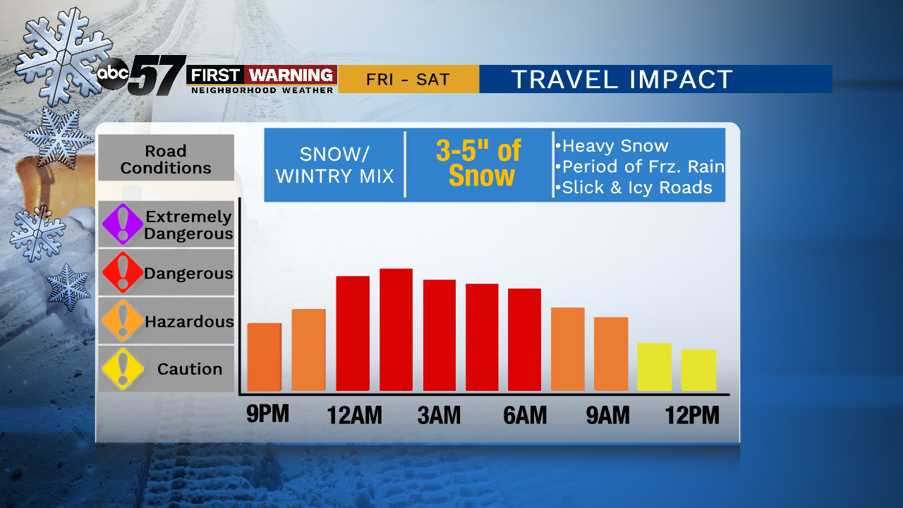
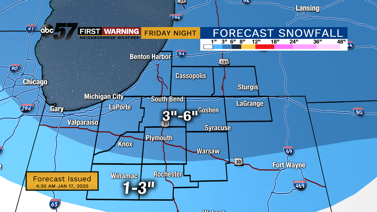
Today starts out quiet but starting around 9 pm, snow showers will move in across the area. Snow could be heavy at times with a quick 3-4" of snow for most. Around 3 AM, snow will turn to sleet then freezing rain. Around 8-9 am Saturday, it should all turn to rain as temperatures rise. This will help melt any snow and ice on the roads and will compact the snow on the grassy surfaces. The sharp drop in temperatures starts Saturday night which will generate lake effect snow. This could lead to slick spots Sunday morning as lake effect snow continues through Monday. You'll need to pack on the layers too, daytime highs are in the teens Sunday!
![](https://newscdn.weigelbroadcasting.com/xSkmw-1579255605-embed-0117%20FRI%20Snow%20Forecast.png)
Today: Mostly cloudy, snow late. High of 30.
Tonight: Snow showers, heavy at times. Temperatures rising from 30.
Saturday: Wintry mix. High of 40.
Sunday: Lake effect snow showers. High of 16.
![](https://newscdn.weigelbroadcasting.com/tlLJH-1579255622-embed-Winter%20Travel%20Forecast.png)