Some patchy fog is developing in Michiana early this morning. With temperatures early Saturday settling into the mid to upper 20s, some freezing fog and isolated slick spots may greet you if you have to head out early.
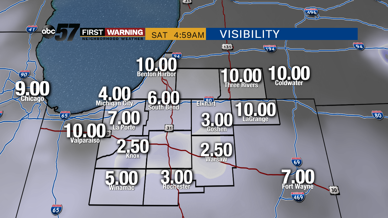 Visibility as of 5 AM Saturday morning. Some slick spots are possible.
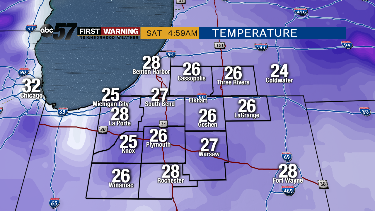 Temperatures as of 5 AM. Thanks to the below freezing air and fog, freezing fog is a concern for a few.
Otherwise, the very slow warming trend continues for the weekend, with highs climbing through the mid to upper 30s over the next few days. Temperatures continue to swell into the mid to even upper 40s by Wednesday and Thursday. Signs of a cold front will knock us back down again, but only for a brief moment, for the last day of the work week.
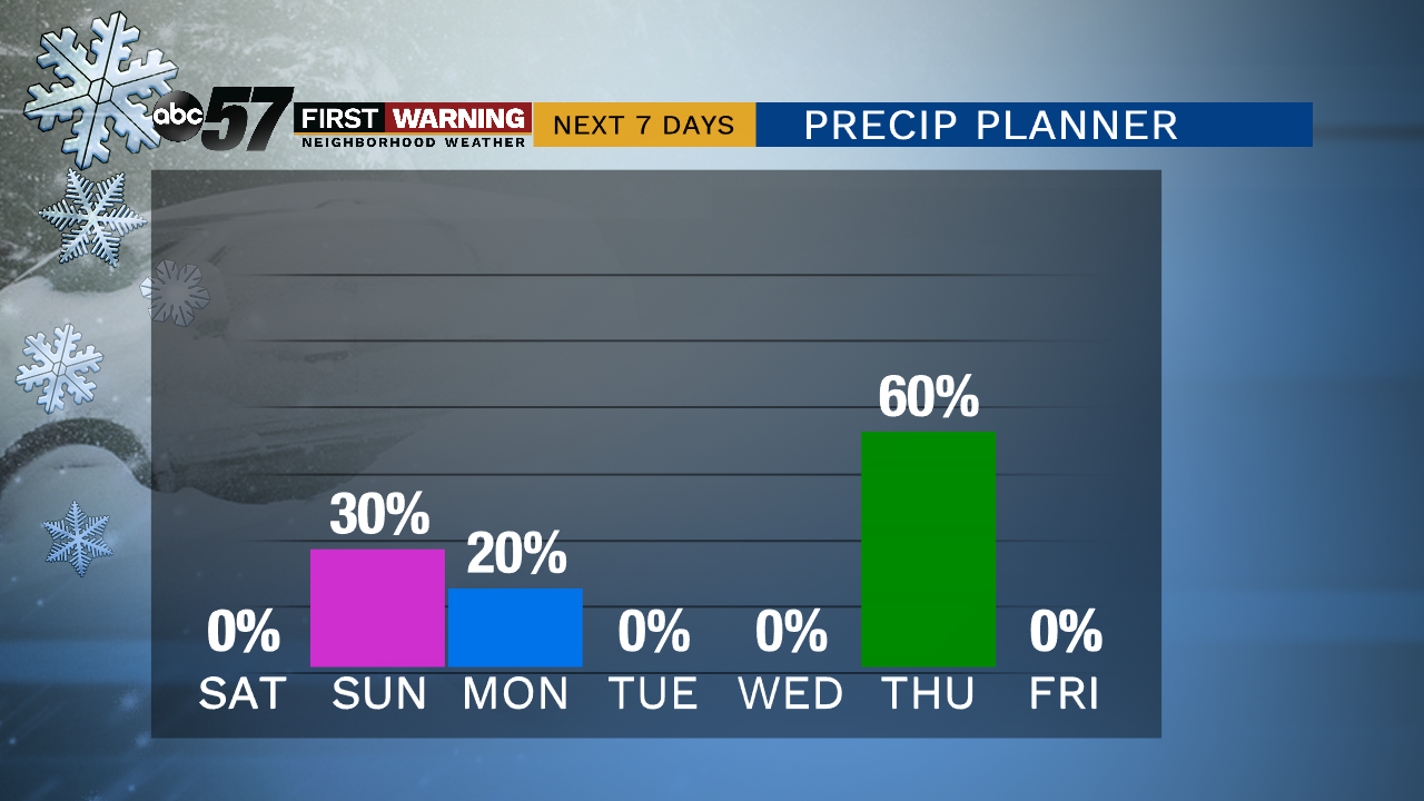 Precip chances are relatively low this week. The next best chance comes Thursday with rain showers.
Precip chances remain relatively low throughout the next 10 days. Some rain/snow showers could impact Michiana late Sunday into Sunday night/Monday morning, but any totals should remain below 1". The next best chance of widespread precipitation will be Thursday as the cold front moves through Michiana.
