
-
2:59

Seven local boards unanimously approve fire territory merger...
-
2:05

JobSpark helps inspire career exploration for middle school students
-
2:01

MPHPL launches new bookmobile to extend library access
-
2:17

Will Pauling shines, Jadarian Price shows versatility at Notre...
-
2:55

Notre Dame’s Pro Day gives 16 seniors one more shot to impress...
-
2:57

South Bend residents voice concerns over proposed pedestrian...
-
3:03

Prices at the pump continue to rise across Michiana
-
1:35

Warming up before storms arrive Thursday
-
2:06

Staying sunny until Thursday
-
0:58

Goshen City Council amends DORA rules amid community concerns
-
1:20

SB Common Council adopts Downtown 2045 Plan
-
2:39

Friends and family celebrate life of Jamecia Moffitt

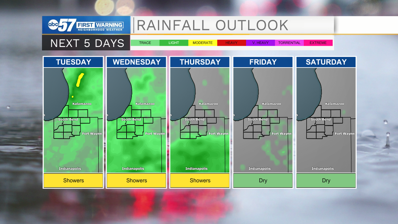
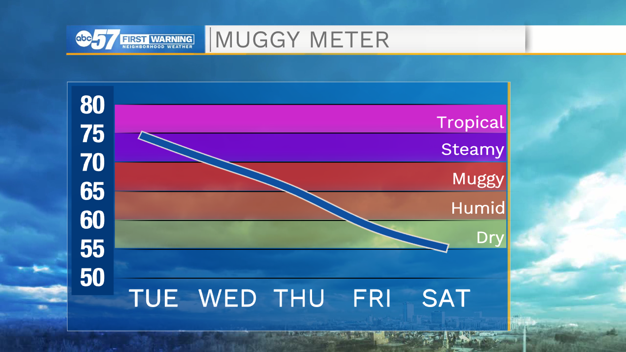
The steamy, stormy pattern continues through midweek. High humidity will provide good conditions for showers and storms to develop and bring localized downpours. After record rainfall this weekend, rivers are peaking and will gradually fall over the next week. The humidity drops Thursday, along with the chance of storms. The holiday weekend is fair and milder, highs in the 70s and 80s.
Tonight: Scattered showers / storms. Low 70.
Tuesday: Showers. Afternoon storms possible. High 86.
Wednesday: Scattered showers. High 82.
Thursday: Isolated showers. High 80.
Sign up for the ABC 57 Newsletter