
-
2:39

South Bend Barber celebrates retirement after 59 years
-
0:57

Thousands take part in Sunburst Run to raise funds
-
2:00

Annual Studebaker car show takes over Ironwood Plaza
-
0:55

Beautiful weekend expected
-
1:05

Truly wonderful conditions
-
0:41

One person left with serious injuries after high-speed pursuit...
-
2:15

Fort Wayne Tin Caps put an end to the SB Cubs winning streak
-
1:21

This weekend is the annual Hall of Heroes Comic Con
-
0:46

Elkhart Police Department respond to shots fired call at the...
-
3:55

ABC57 speaks with Cass County Commissioners, Judge and Interim...
-
2:48

Common Council to consider appeal options following South Bend...
-
0:52

South Bend seniors explore local parks, event centers, and available...

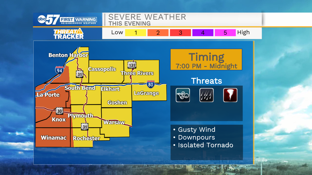
Scattered storms are likely this evening, some storms could be strong to severe, 9:00 to 11:00 p.m. is the most likely timeframe for storms.
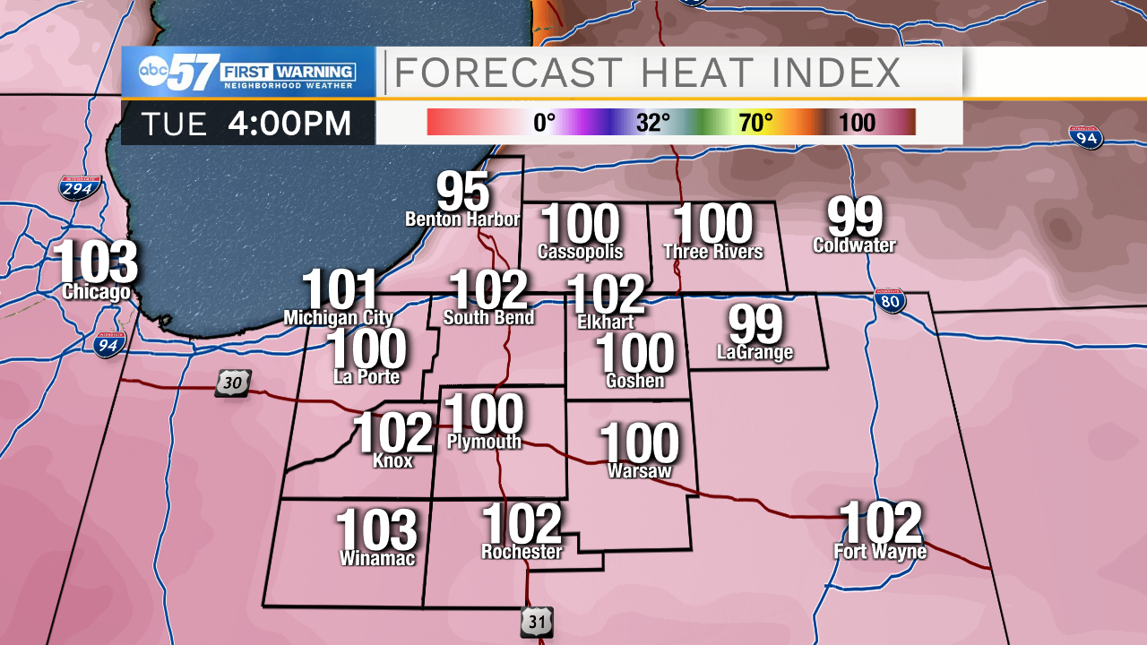
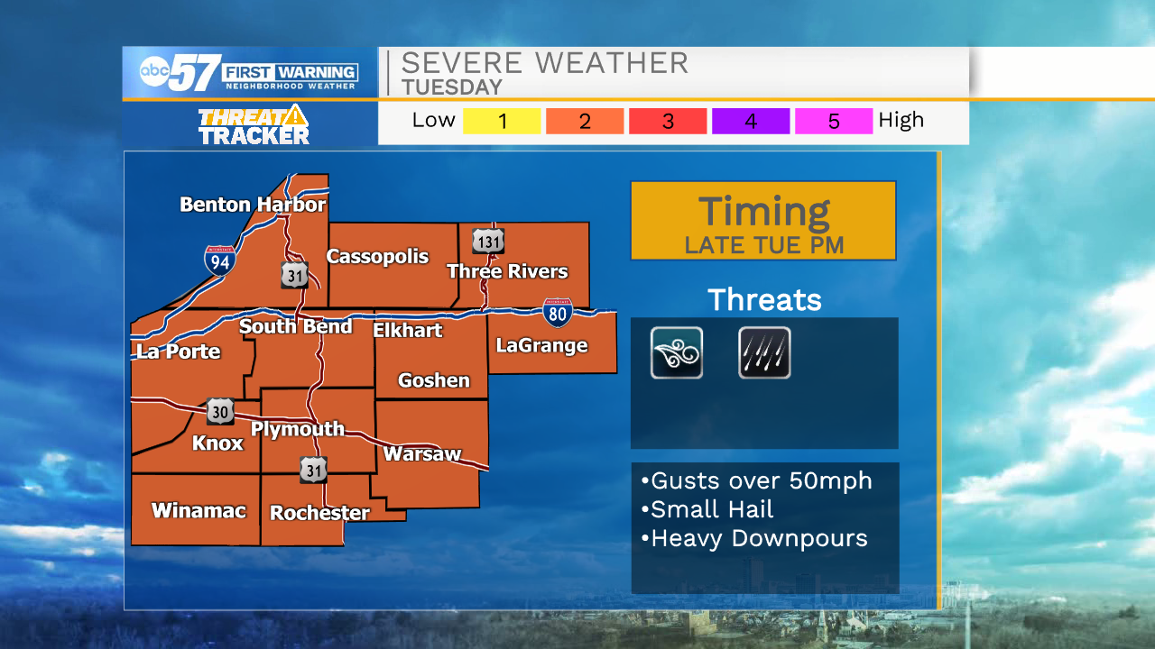
This looks to be the hottest week of 2021, the heat index will peak above 90 through Thursday, Tuesday looks to be the hottest day with a heat index +100°. With Tuesday's heat there is the potential for strong storms but how they develop is still questionable, which could mean a miss for the area. In general, everyone should plan for extreme heat and humidity and pop-up afternoon/evening storms, through Thursday. The heat breaks to end the week, with highs in the low 80s this weekend.
Tonight: Scattered thunderstorms, possibly strong to severe. Low 72.
Tuesday: Extreme Heat. Evening storms. High 92.
Wednesday: Scattered thunderstorms. High 90.
Thursday: Scattered thunderstorms. High 89.