Storms late this evening but the end of the week is drier
By: Emily Kennedy
Posted: Jul 21, 2020 3:03 AM EDT

-
2:34

From Niles to South Bend: Jays 2 Keeps the Spirit Alive for basketball...
-
0:46

44th annual Tri Kappa Antique Show boosts charities and scholarships
-
1:48

Scattered showers this evening, Much cooler overnight
-
1:50

Showers and storms this afternoon
-
0:20

One person injured in shooting
-
0:36

Eddies Circuit Robotics holds competition Saturday
-
0:32

21st annual Nappanee Model Train Show
-
0:38

Local boys basketball team headed to IHSAA state finals
-
3:49

Midwest Meowfest brings kitten advocacy to attendees, new homes...
-
1:52

Mild tonight, showers tomorrow
-
1:43

Pleasant to start the weekend
-
3:06

Pulaski County weighs stricter solar rules amid resident concerns

ABC57 First Warning Neighborhood Weather
Tuesday, July 21st, 2020
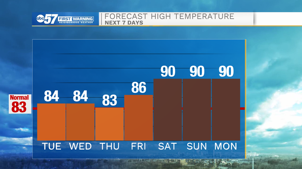
Temperatures remain in the low to mid-80s through this week with some mugginess. Clouds increase this morning with showers/storms arriving after 7pm. Showers/storms become widespread overnight and a shower could linger into Wednesday morning. The rest of the week looks nice and dry. This weekend heats back up! Daytime highs return to the low 90s.
Today: Mostly cloudy. Showers/storms late. High 84.
Tonight: Scattered showers and storms. Low 70.
Wednesday: Early shower possible, mostly cloudy. High 84.
Thursday: Mostly sunny. High 83.
Sign up for the ABC 57 Newsletter