Strong Fall system moves through bringing wind and rain


Tuesday, November 26th, 2019
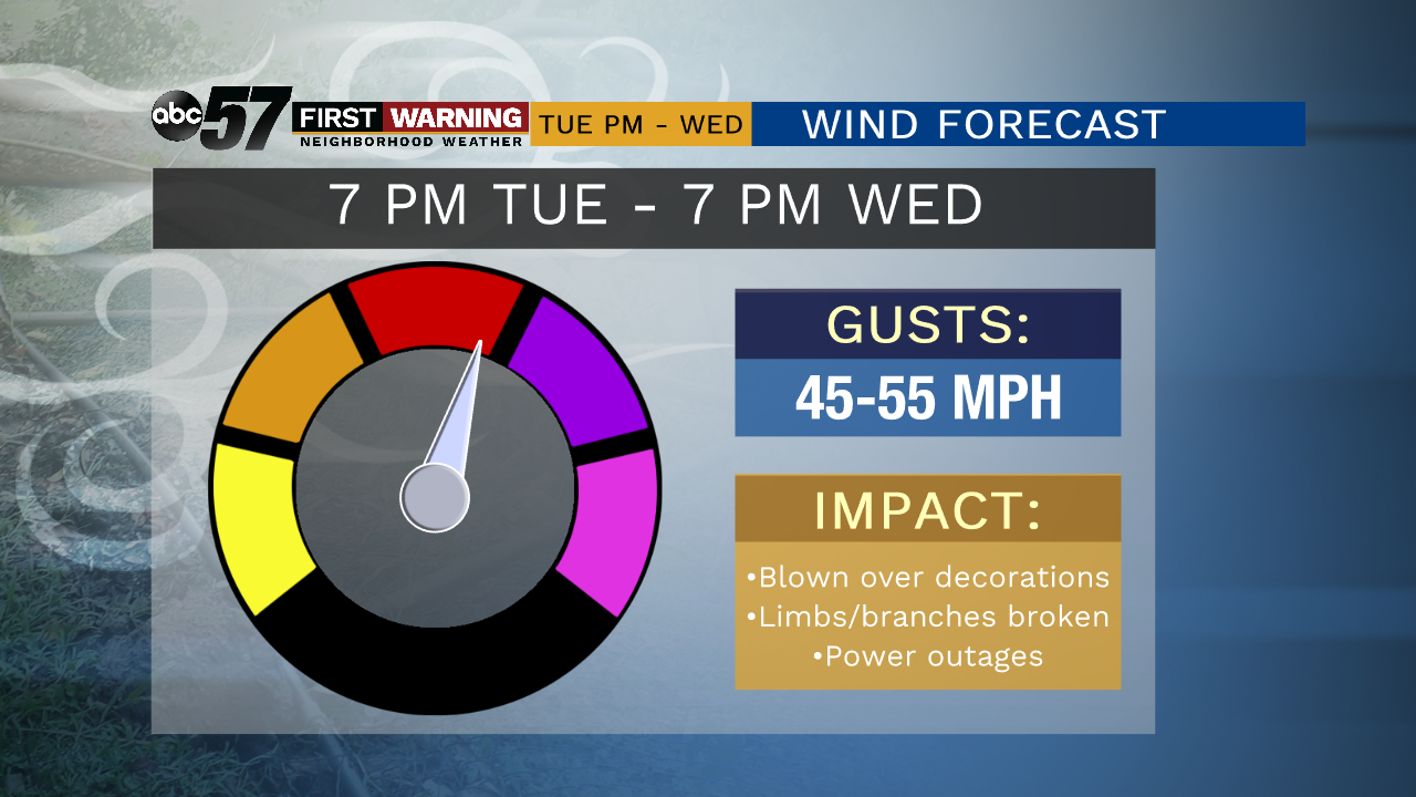
Areas of dense fog this morning could cause delays for the morning commute. As the fog clears late this morning, clouds will move in this afternoon with scattered rain showers possible after midday. Rain is likely tonight and could be heavy at times as the strong Fall system pushes into the area. Winds will pick up because of it, becoming strong on Wednesday. Due to expected wind gusts of 45-55 mph, there is a High Wind Watch posted for Wednesday.
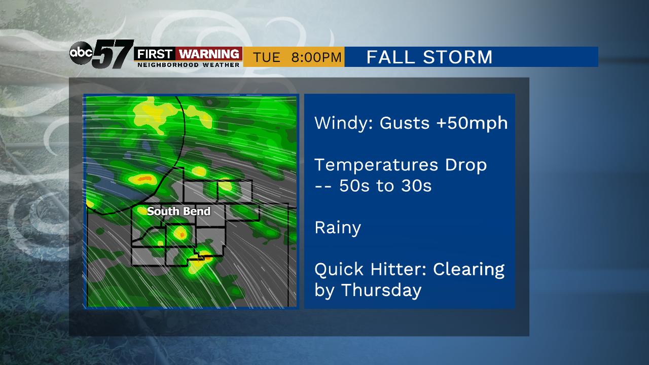
Most of the rain will wrap up by Wednesday afternoon, but we will be left colder. Daytime highs go from the low 50s to low 40s for Thanksgiving but at leas the weather will be quiet. Black Friday remains calm before the next system moves through over the weekend.
Today: Increasing clouds, showers possible by late afternoon. Windy. High of 50.
Tonight: Scattered rain, heavy at times. Low of 49.
Wednesday: Morning rain and very windy. Temperatures falling from 52.
Thanksgiving: Mostly cloudy. High of 40.