


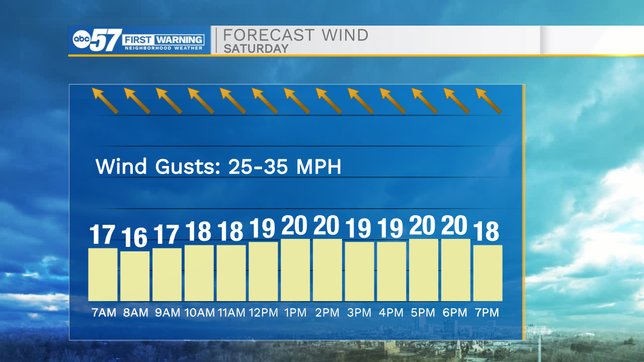
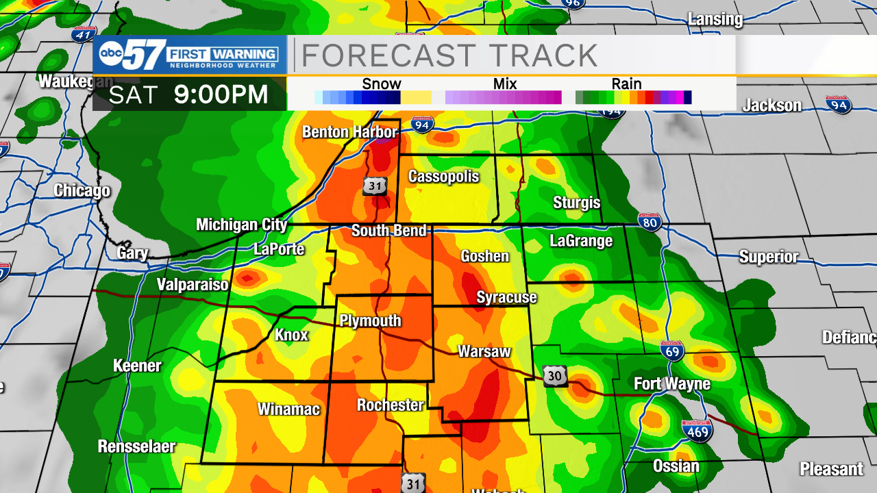
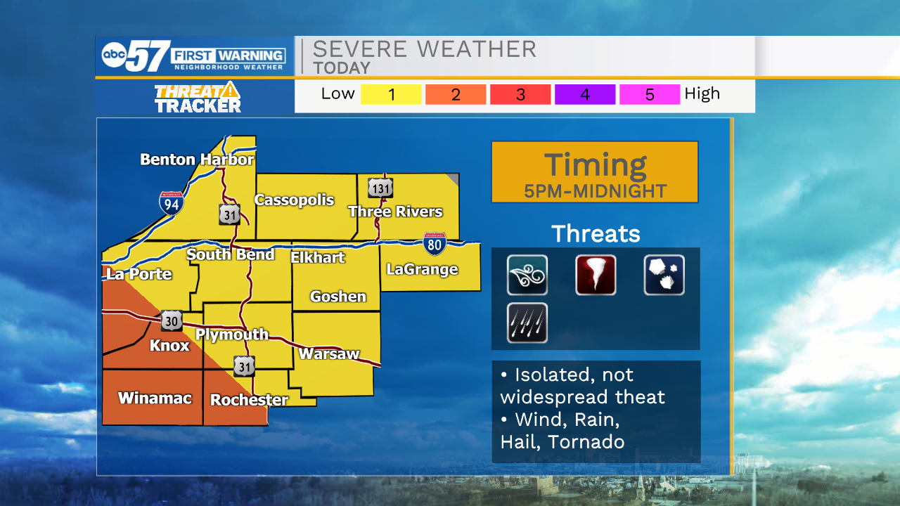
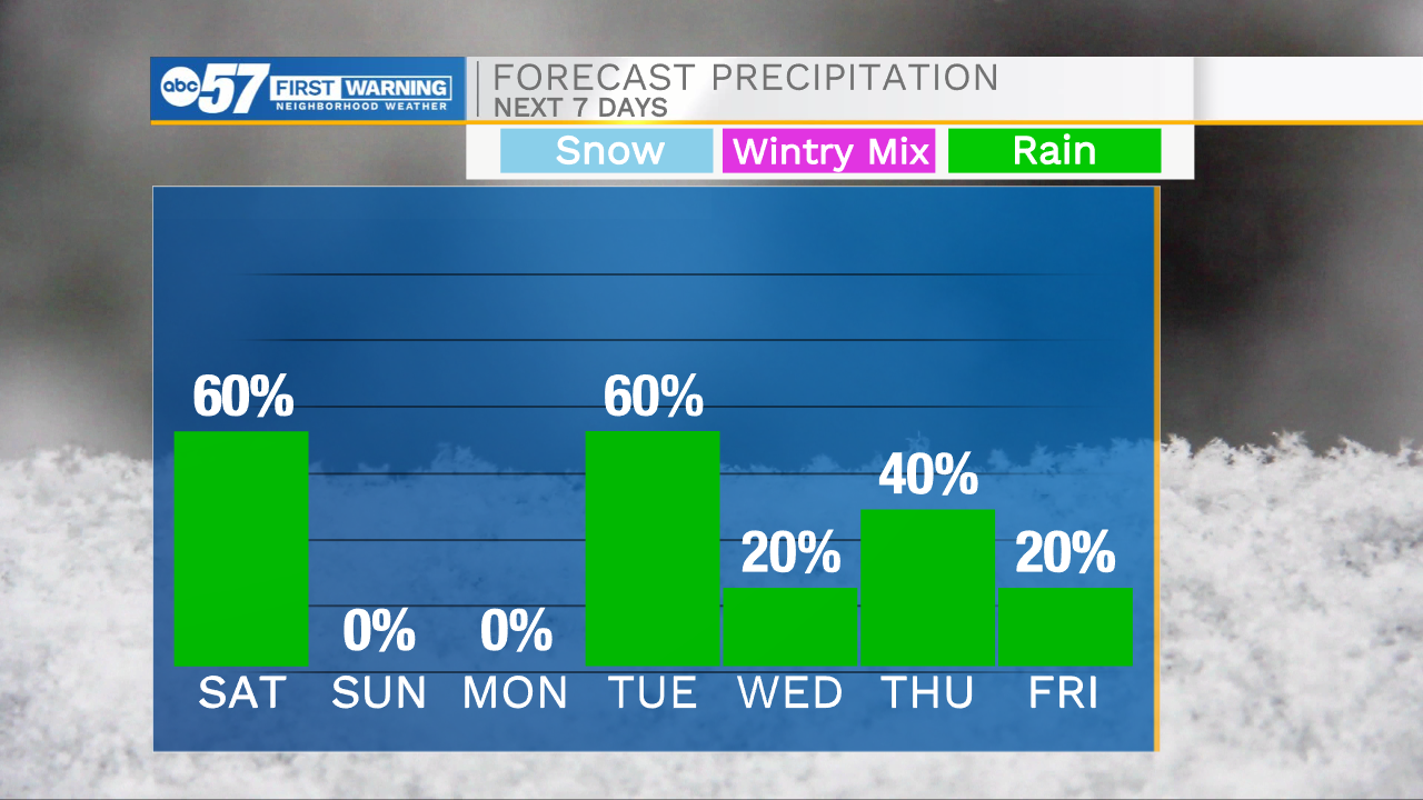
This morning a few isolated rain showers will impact portions of Michiana before clearing out closer to lunchtime. We will catch a few dry hours early this afternoon before a round of showers and storms arrive around 4-5pm. A few of these storms could be strong to severe with large hail and damaging wind gusts being the two biggest threats. There is a low tornado threat that we will be monitoring closely. All storm activity should clear closer to midnight. Quieter weather is in store for your Sunday, with a little sunshine returning to the forecast. High temperatures this weekend will be near 70 today, then the mid 60s tomorrow. We are also tracking some gusty winds through the weekend as well. Another round of scattered showers and isolated thunderstorms arrive Monday night into Tuesday. That round of rain looks to mostly clear by Wednesday. High temperatures for the start of the week will be in the mid to upper 60s. Rain chances will mostly dominate the later half of the work week as well before mostly clearing out by next weekend.
Today: PM Thunderstorms. High 70.
Tonight: Thunderstorms. Low 54.
Tomorrow: Mostly cloudy. High 66.
Monday: Partly cloudy. High 66.