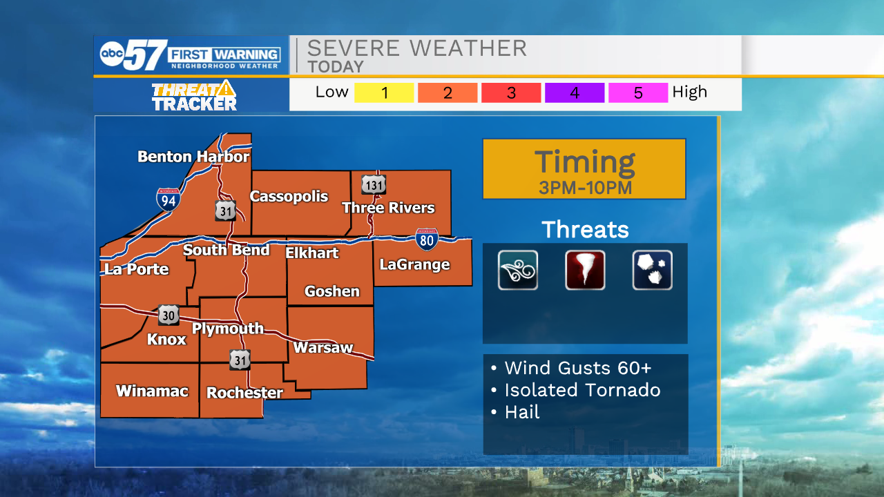
Strong to severe storms possible this afternoon and evening


It is a very warm start to the day with temperatures in the mid 60s. This warm air will mix with plenty of moisture moving in out of the south and a cold front arriving this afternoon. This will spark rain and storm chances throughout Michiana during the early afternoon and evening. A few of these storms could be on the strong to severe side with the two main threats being damaging winds and a possible tornado or two. Showers and storm will stick around through the overnight, but after 10pm our severe threat will diminish. Rain showers should clear before lunchtime tomorrow. High temperatures will drop into the 50s for Monday and the 40s for Tuesday and Wednesday. This week looks mostly dry, but then rain chances return to the forecast heading into next weekend. Highs will rebound back into the lower 60s by Friday.
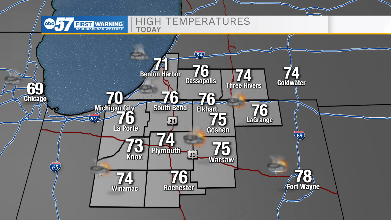
Today: PM Thunderstorms. High 76.
Tonight: Scattered showers. Low 50.
Tomorrow: AM Rain. High 58.
Tuesday: Partly cloudy. High 48.