Sunshine and mild temperatures today, Rain chances return Sunday


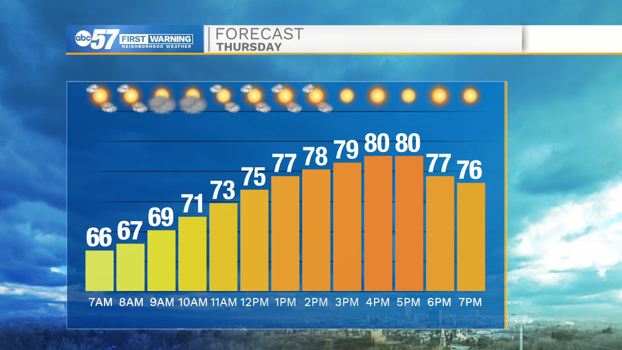
It is setting up to be a beautiful day with lots of sunshine! Highs this afternoon will only top out in the lower 80s with low humidity. The dry weather will hold through the end of the week. Temperatures will push back into the mid 80s tomorrow afternoon.
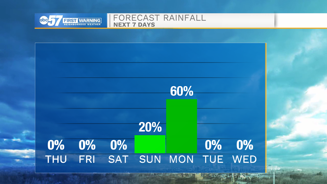
This weekend high temperatures will make a secondary surge back into the upper 80s, to even 90 degrees by Sunday. Along with the heat, humidity will also return with dewpoints hitting the upper 60s to lower 70s. Rain showers and thunderstorms are possible later on Sunday as a cold front slides in from the northwest. Showers and storms will stick with us throughout most of Monday.
High temperatures next week will begin to fall back into the lower 80s. We should see more dry weather return by mid next week.
Today: Mostly sunny. High 80.
Tonight: Mostly clear. Low 62
Friday: Mostly sunny. High 84.
Saturday: Mostly sunny. High 88.