
-
2:10

Mishawaka honors fallen officers
-
2:52

Two Hoosiers serving as Perpetual Pilgrims for the National Eucharistic...
-
2:31

Berrien RESA holds public hearing to discuss starting school...
-
2:26

Officials break ground on $20 million facade, traffic flow project...
-
3:34

Brian Conybeare interviews Jennifer Copeland’s dad, Dr. Larry...
-
1:13

Shamrocks Sports Bar opens next to Four Winds Field
-
2:24

New Carlisle opens the door to back yard beekeeping
-
4:19

Elkhart High School and Mosaic promoting accessibility with flag...
-
1:13

Cool and windy today
-
1:07

A breezy and cool start to Wednesday
-
0:56

Porter Township leadership pass one-year data center moratorium
-
2:38

Howard Charter Township Residents to Vote on Dissolving Charter...

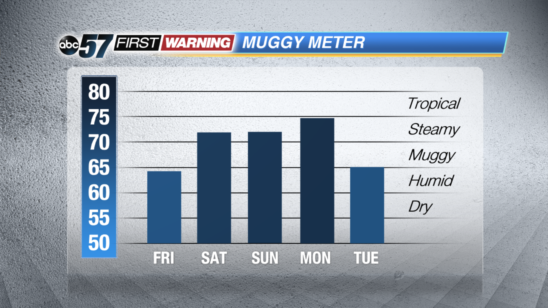
Temperatures climb and the humidity spikes this weekend. Highs in the 90s and a heat index near 100 will make for hazardously hot conditions. Practice heat safety keeping cool and staying hydrated. The chance of isolated showers and storms will also be in the forecast, the best chance coming early Saturday.
The heat breaks Monday night with a strong cold front that is likely to produce a line of thunderstorms that could be strong to severe. Timing of the front will critical in forecasting the likelihood of severe weather.
Tonight: Mostly clear, low of 60.
Friday: Mostly sunny, high of 86.
Saturday: Partly cloudy, mainly AM isolated t-storms, high of 90.
Sunday: Hot and humid, highs in the low to mid 90s, heat index near 100.
Sign up for the ABC 57 Newsletter