
-
0:49

Gas leak at remains of Zimmy’s Tavern leads to temporary evacuation...
-
2:12

South Bend City Council passes resolution urging pause on Midwest...
-
0:46

Niles City Council vote yes on putting marijuana question on...
-
0:29

Multiple Fire Departments battle residential fire in Berrien...
-
2:10

Notre Dame men’s basketball embracing urgency as Shrewsberry...
-
2:37

Local Beef-A-Roo employees still owed paychecks as private equity...
-
1:42

More storms through 8:00 p.m.
-
1:06

2nd annual Inclusive Art Fair
-
2:20

Tracking severe weather through the mid-afternoon
-
3:17

Applications open for Fall Citizens Police Academy in South Bend
-
2:23

Elkhart County 4H Fair food vendors celebrate 50th year of business
-
2:16

Young football athletes learn about protecting their bodies,...

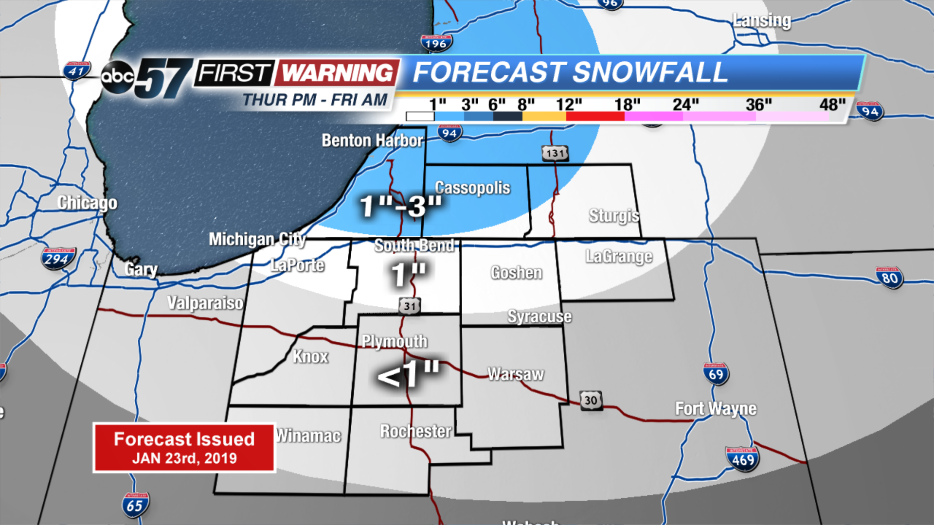
The deep freeze begins Thursday, with subfreezing temperatures for the foreseeable future, some nights will fall below zero. The first of many rounds of snow starts Thursday afternoon, a weak clipper will bring a range of one to three inches to the lake effect zones. More of the same through the weekend, systems spacing themselves by roughly 24 hours apart. Monday snow might be the most widespread and impactful snow but that will come down to the track of the storm. Stay tuned and stay warm, the heart of winter is here.
Tonight: Mostly cloudy with a chance of snow showers. Low of 16.
Thursday: Mostly cloudy with snow showers starting in the evening. High of 24.
Friday: Morning snow showers. High of 8.
Saturday: Morning show showers. High of 16.