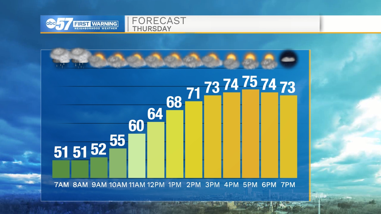
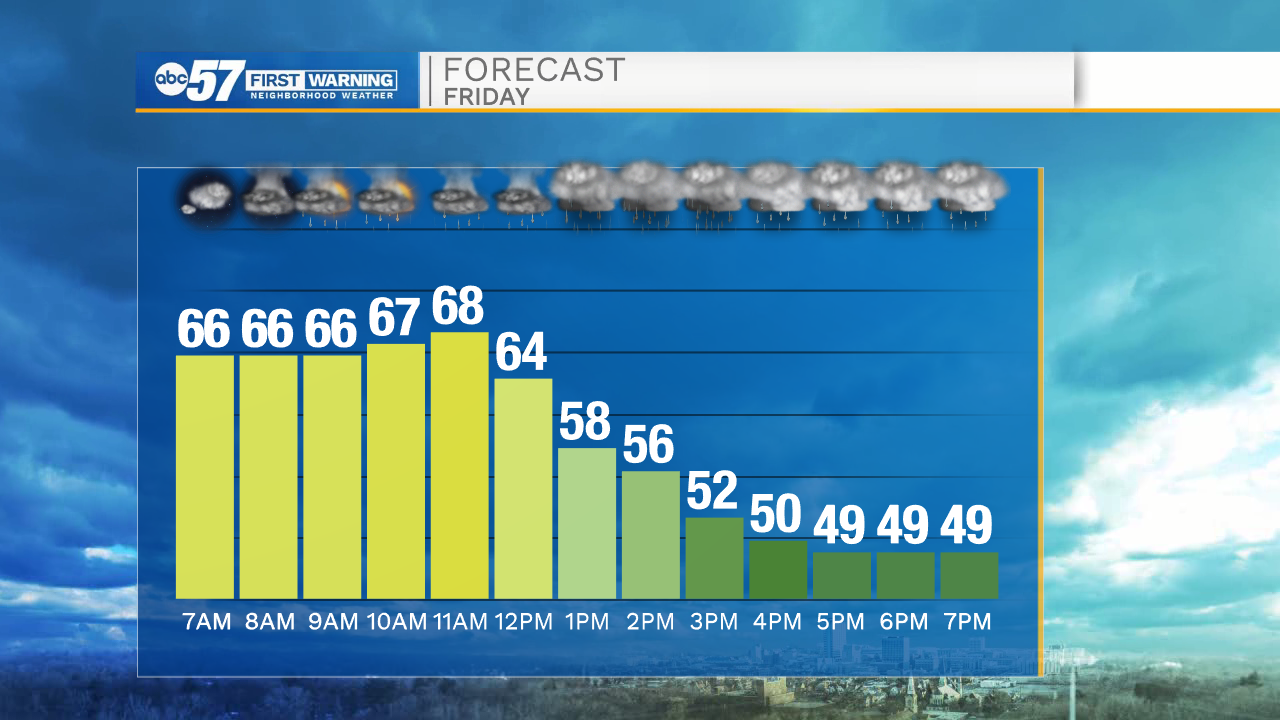
The warm-up Thursday, before temperatures crash Friday
By:
Tom Coomes
Posted: Oct 21, 2020 4:12 PM EDT

-
1:06

Marshall County Humane Society reschedules Dog Egg Hunt
-
2:01

Martin Luther King Dream Center hosts MLK March in South Bend
-
1:54

South Bend Cubs opener postponed by weather, but fans still find...
-
2:01

Sights and sounds from South Bend Cubs Opening Day
-
1:32

NIPSCO ’flatly rejected’ further negotiations, USW workers...
-
3:36

The art of groundskeeping at Four Winds Field
-
3:32

The history behind America’s only ballpark synagogue turned...
-
1:59

South Bend opens season against Quad Cities in familiar Midwest...
-
4:21

South Bend Cubs owner discusses $48M stadium expansion, changes...
-
3:19

A look into the new South Bend Cubs 2026 roster
-
5:17

Expansion goes beyond Four Winds Field, new restaurants, bars,...
-
6:18

What’s new this season? South Bend Cubs unveil major improvements...

Scattered showers start Thursday ahead of a quick warm-up. The wind turns southerly and temperatures spike into the mid-70s. Thursday night is mild ahead of the advancing cold front that will drop temperatures suddenly midday Friday. A near 20-degree drop is possible from noon to mid-afternoon. Scattered showers and storms are likely, damaging severe weather is unlikely but blustery wind is also likely. The weekend is cool again with highs in the 50s.
Tonight: Scattered showers late. Mostly cloudy. Low 48.
Thursday: AM showers. Partly cloudy, breezy, warm. High 75.
Friday: Temperatures fall from 70 midday. Scattered showers/storms, gusty wind.
Saturday: Partly cloudy. High 52.
Sign up for the ABC 57 Newsletter