
-
3:41

Present Pillars to host “Dad Strong 5K“ to support fathers...
-
1:44

Warming up through Wednesday
-
2:34

From Niles to South Bend: Jays 2 Keeps the Spirit Alive for basketball...
-
0:46

44th annual Tri Kappa Antique Show boosts charities and scholarships
-
1:48

Scattered showers this evening, Much cooler overnight
-
1:50

Showers and storms this afternoon
-
0:20

One person injured in shooting
-
0:36

Eddies Circuit Robotics holds competition Saturday
-
0:32

21st annual Nappanee Model Train Show
-
0:38

Local boys basketball team headed to IHSAA state finals
-
3:49

Midwest Meowfest brings kitten advocacy to attendees, new homes...
-
1:52

Mild tonight, showers tomorrow

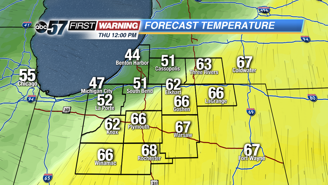
A stormy start to Thursday. Heavy rain and rumbles of thunder are likely. The timing is still not favorable for severe weather but localized wind gusts and heavier downpours are possible. Rain continues most of Thursday and temperatures fall sharply when a cold front passes midday. Friday will be breezy with highs near 50, the weekend is fair with highs near 70 by Easter Sunday.
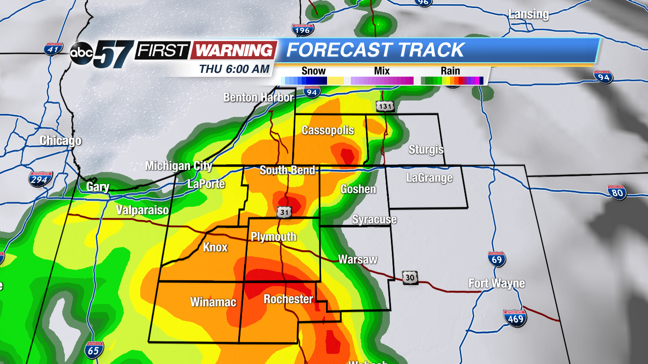
Tonight: Storms likely by morning, low of 58.
Thursday: Rain and thunderstorms, temperatures fall from 62.
Friday: Mostly cloudy, breezy, high of 50.
Saturday: Mostly sunny, high of 58.
Sign up for the ABC 57 Newsletter