
-
2:11

This week’s ABC57 Cub Reporter is Lucas Castillo
-
2:28

Local landscaper turns heads with his manicured lawns and young...
-
4:52

U.S. senators representing Michiana work to ban government officials...
-
5:04

Family, friends, and South Bend community members mourn beloved...
-
5:25

Exclusive look inside Angels in the Attic operations and their...
-
0:49

INDOT makes public presentation to residents of Middlebury about...
-
2:53

Friendly poodle brings smiles, alleviate stress at the Ivy Tech...
-
1:05

Notre Dame’s Comfort K9 program is breaking down barriers,...
-
2:23

Notre Dame softball rallies past DePaul in regular-season finale
-
3:04

Berrien County community asks sheriff to withdraw from partnership...
-
3:33

Notre Dame alum crucial part of Artemis II mission
-
1:55

The UAE is leaving OPEC soon, here’s why

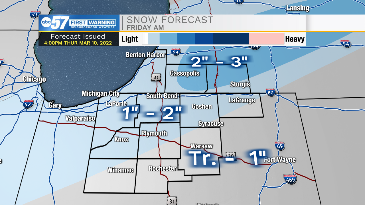
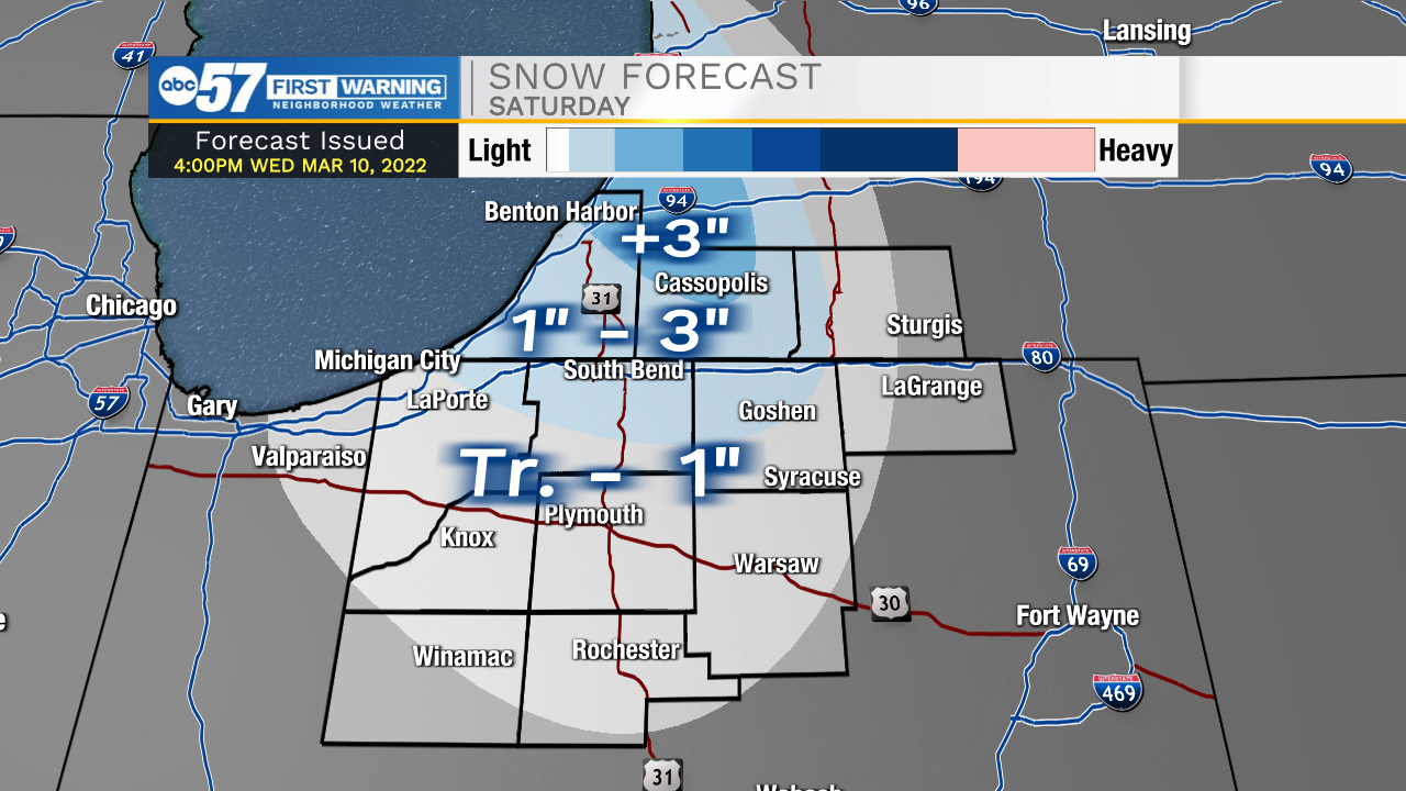
Friday will start with a couple inches of snow on the ground, roads may be more wet than snowy, but don't underestimate the snowfall as roads may be slick. There's no snow the rest of Friday, and pavement likely clears as temperatures warm into the mid-30s. Friday night through Saturday is cold and windy. Wind gusts top 30 mph and the wind chill nears zero Saturday morning. Lake effect snow showers could bring an additional one to three inches to the snow belt. All will be forgotten by Sunday, with sunshine and highs near 50!
Reminder: Daylight Saving Time begins at 2:00 a.m. on Sunday, March 13. We spring forward one hour.
Tonight: Snow showers. Low 24.
Friday: Snow ending, Becoming windy. High 36.
Saturday: Cold, windy, lake effect snow showers. High 24.
Sunday: Partly cloudy, breezy. High 50.