


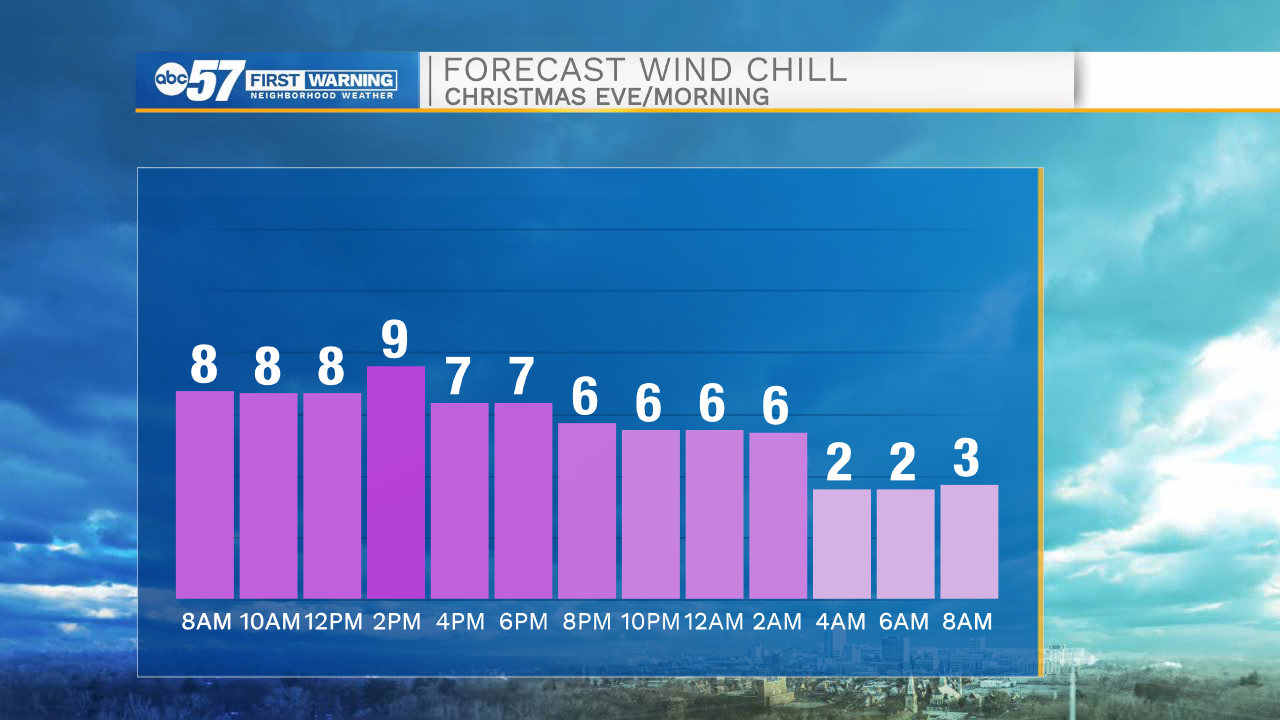
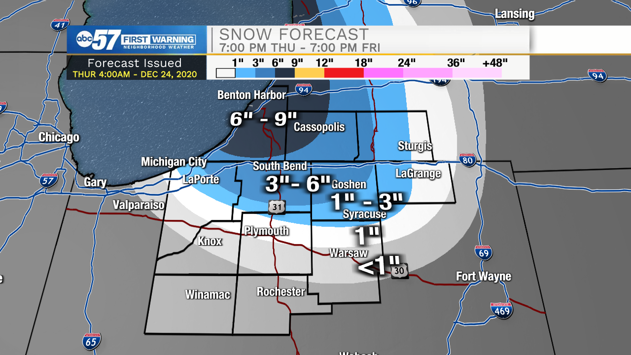
Temperatures will rapidly fall this morning until lunchtime where lows are expected to hit the upper teens to lower twenties. Wind chill temperatures will stay in the single digits for most of the day. There is slight concern for flash freezing this morning as well. With the wet roadways from last nights rain and the freezing temperatures slicks spots are possible. Isolated snow flurries are possible throughout the day, and then will turn to snow showers this evening. Lake effect snow will impact northern and portions of central Michiana during the overnight. These snow showers could last until tomorrow afternoon. If you are driving in LaPorte, St. Joseph, Berrien, or Cass counties tomorrow, leave yourself plenty of extra time and reduce speeds. Snow accumulations could range from 6-9 inches in a few isolated areas tomorrow (See attached snow totals below). Christmas day will be very cold with temperatures in the 20s. Saturday looks dry, but rain and more snow chances return late Sunday into early Monday morning.
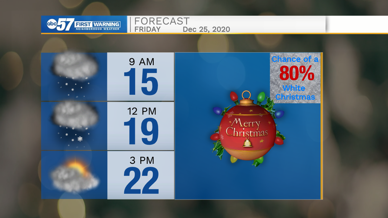
Today: Very cold. High 22.
Tonight: Snow showers. Low 14.
Tomorrow: Snow showers. High 22.
Saturday: Partly cloudy. High 34.