Warm and breezy with more rain on the horizon


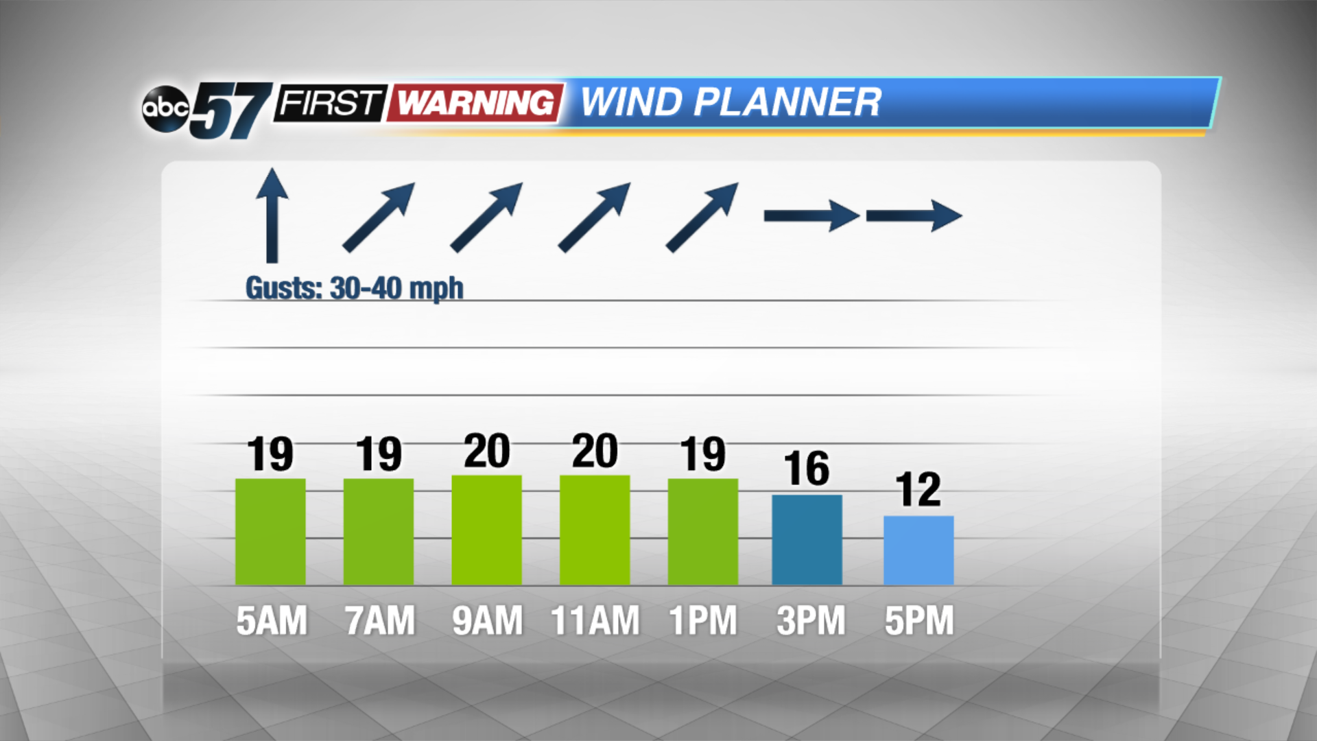
A showers linger into the early morning commute but it quickly dries out for the rest of the day. We’ll see a mix of sun and clouds and it’ll feel like early summer as highs top out near 70! Winds are breezy through the next couple days with more clouds moving back in tomorrow. Highs are back in the low 70s Friday but a few isolated showers and storms are possible after midday. The strong low pressure system moves in Saturday, keep us soggy with a few thunderstorms.
Temperatures take a tumble into Sunday, falling into the 40s. Next week starts out chilly with a possible mix of rain and snow but we warm back up through the week.
Today: Chance rain early, breezy with a mix of sun and clouds, highs near 70.
Tonight: Mostly cloudy, breezy, low of 52.
Friday: Mostly cloudy, chance of showers, high of 72.
Saturday: Rainy, thunder possible, temperatures fall from the mid-60s.