Warm and humid Tuesday; storm chances continue this week


Another warm, humid day is in store for Tuesday.
Temperatures this afternoon will warm to the upper 80s. It will be mostly to partly sunny today, with a few more clouds developing this afternoon.
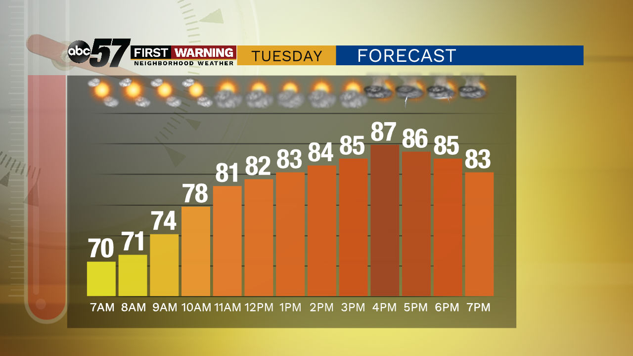
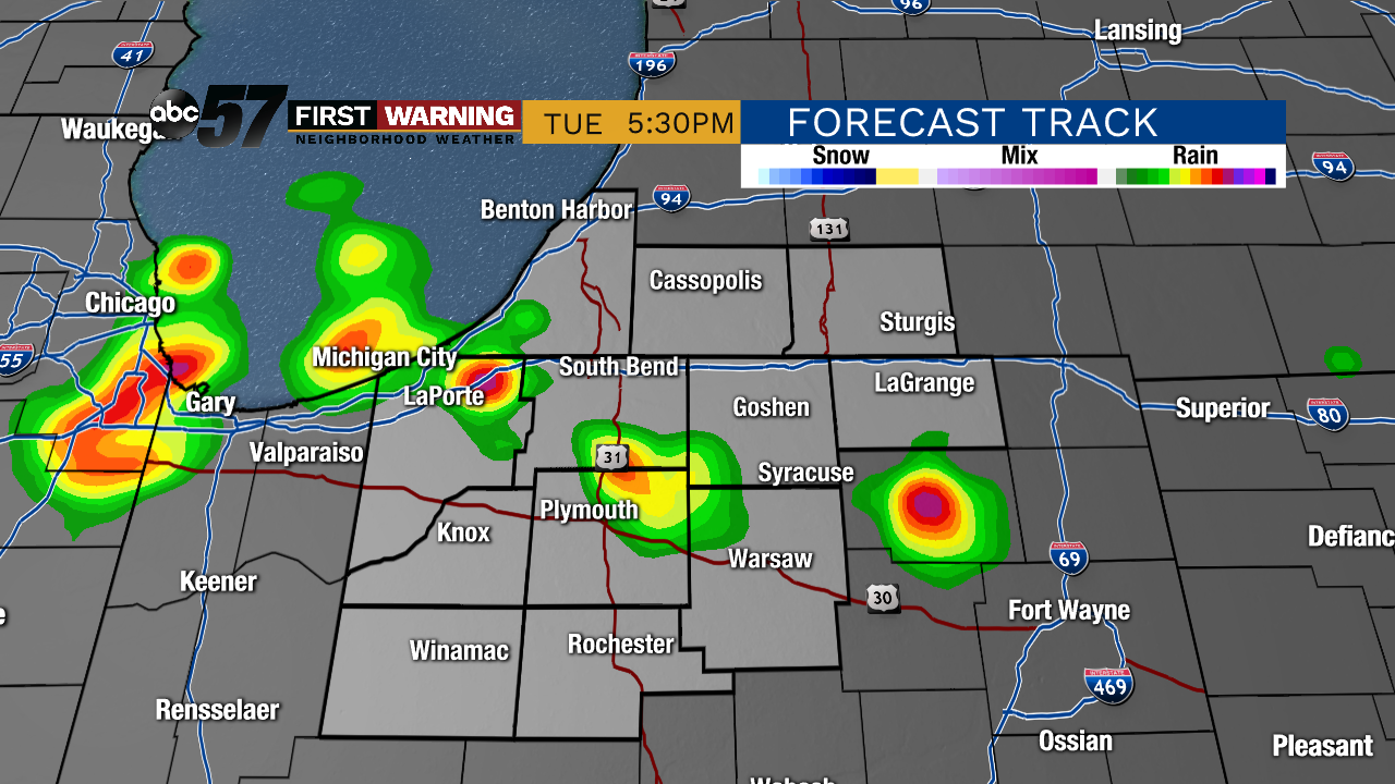
There is a chance for isolated thunderstorms or showers this afternoon, especially after 4 PM. Most of the day should stay dry.
Wednesday and Thursday both have higher storm chances. Both days will be mostly cloudy with scattered thunderstorms and showers. There is a cooling trend over this period as a cold front passes. Temperatures stay in the low 80s Wednesday and Thursday, but will reach the 70s for Friday and the weekend.
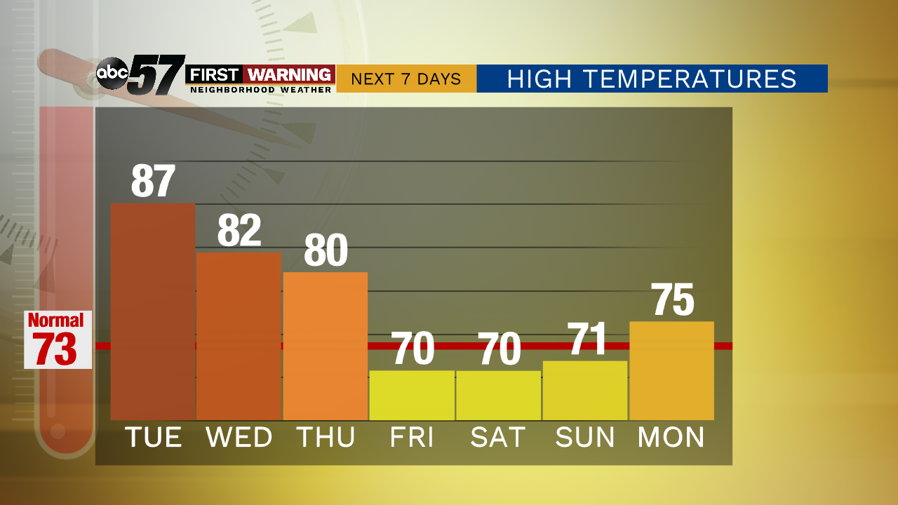
A few showers are possible early Friday morning, then the rest of the day should be partly sunny. Dry, sunny conditions will last from Friday afternoon through early next week.
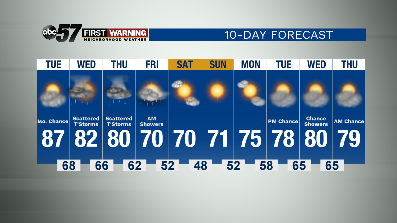
Today: Partly sunny. Chance for a few afternoon thunderstorms or showers. High 87.
Tonight: Partly to mostly cloudy. Chance isolated thunderstorm or shower. Low 68.
Wednesday: Scattered thunderstorms. Mostly cloudy. High 82.
Thursday: Scattered thunderstorms. Mostly cloudy. High 80.