Warm temperatures and rain chances to start the work week


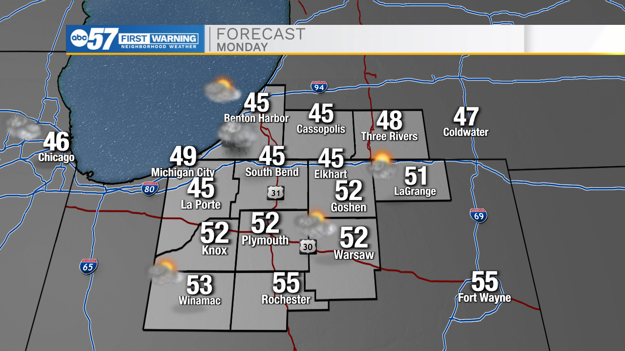
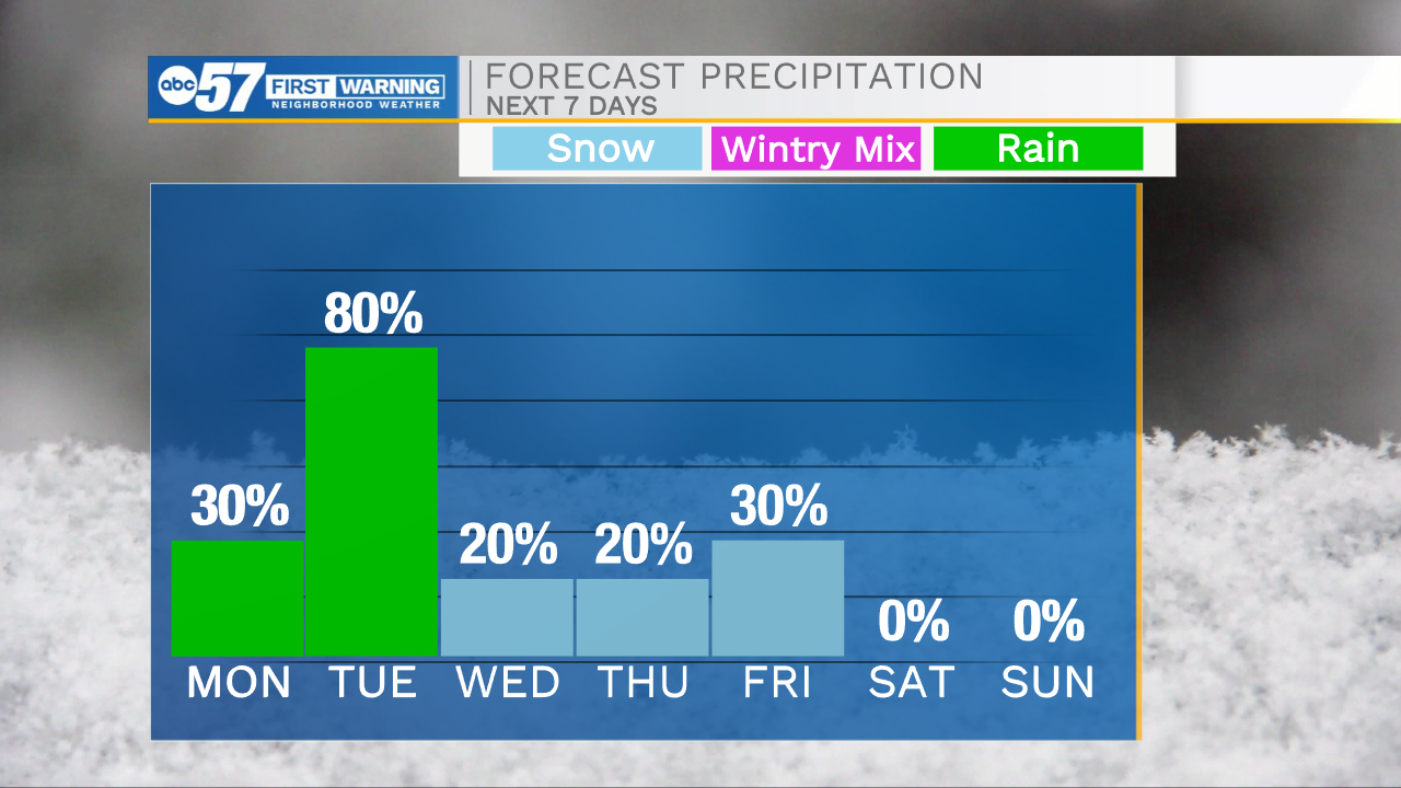
It has turned out to be a beautiful day throughout Michiana. Hopefully you have been able to get outside to enjoy the nice weather. Slight cloud cover will build in during the overnight helping to keep temperatures in the mid 30s tomorrow morning. Highs tomorrow afternoon will warm into the mid to upper 40s. Rain chances make their way back into the forecast during the mid to late evening tomorrow. Scattered showers will then stick with us through Tuesday. A few rumbles of thunder and brief heavy downpours are possible. This rain mixed with lots of snow melt will keep the flooding potential on the higher side heading into the beginning of the work week. Total rain accumulation looks to range from 0.5-0.75 inches. Tuesday afternoon highs will hit the lower 50s, but then another cold front arrives dropping temperatures back into the 20s and 30s through the rest of the week and next weekend.
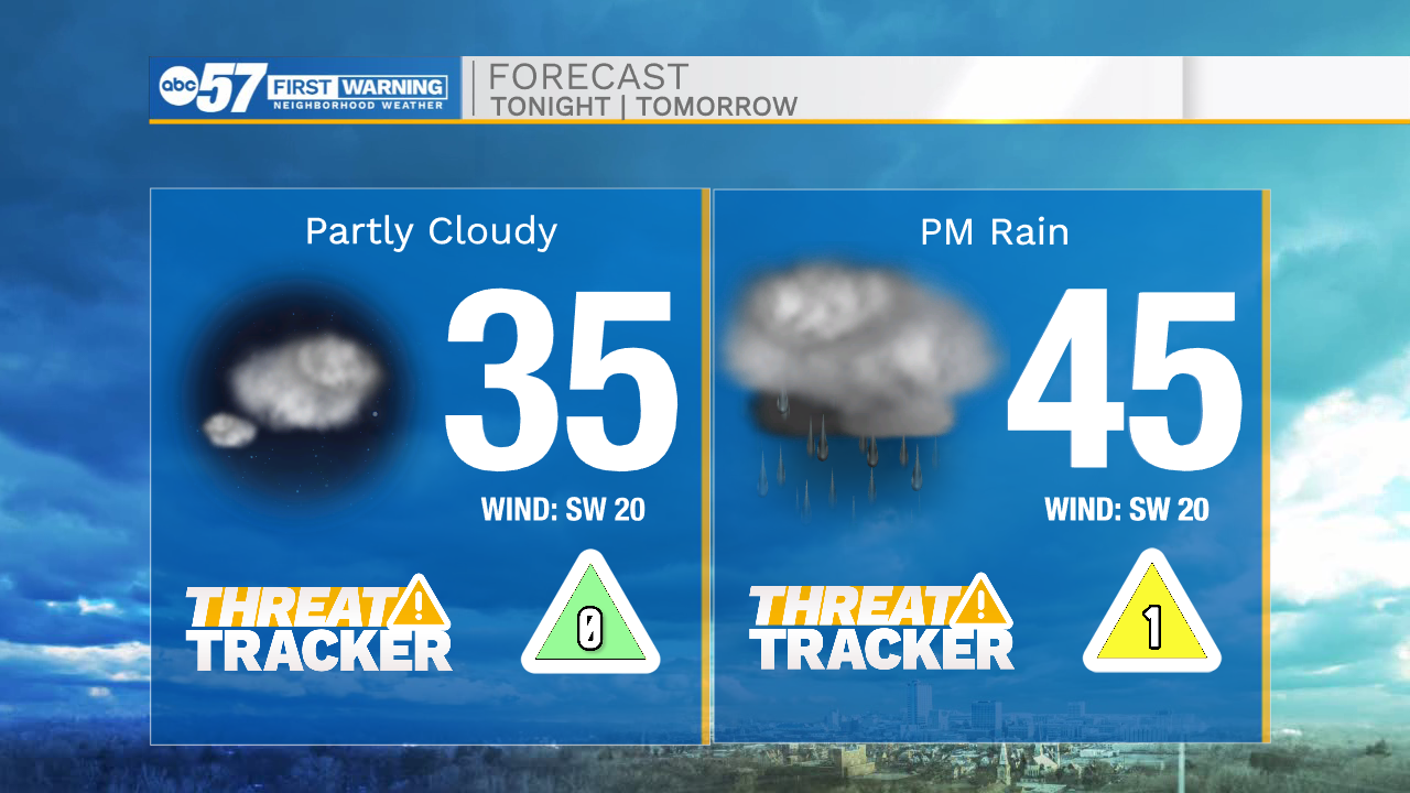
Tonight: Partly cloudy. Low 35.
Tomorrow: Partly/mostly cloudy/PM rain. High 47.
Tuesday: Scattered showers. High 52.
Wednesday: AM flurries. High 28.