Warming trend continues heading into the work week

-
1:03

Lighter rain expected into the afternoon
-
1:04

Non-severe storms expected
-
1:16

Showers start this morning
-
1:59

Mac & Cheese festival turns Four Winds Field into a kitchen
-
0:45

Michiana Spring Clay tour encourages people to try and take a...
-
2:56

Fresh Cuts, Fresh Starts: Re-Entry Program Gives Back in Elkhart
-
0:53

Jr. Irish Memorial Day invitational celebrates veterans and active-duty...
-
1:15

Another rain chance this holiday weekend
-
0:46

Holiday weekend starts rainy
-
1:13

South Bend West Side Memorial Day Parade Preview
-
0:48

Three Rivers Menards partially reopens after suffering extensive...
-
1:53

Reactions from race fans at Plymouth Motor Speedway to the passing...

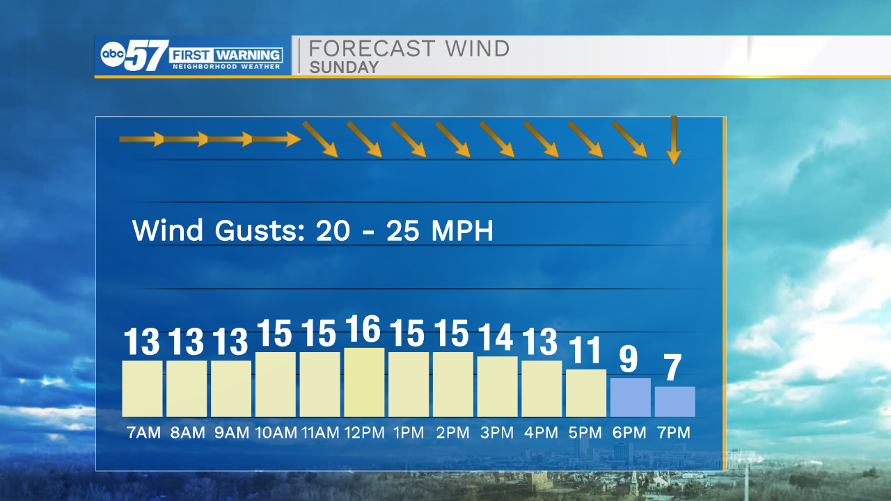
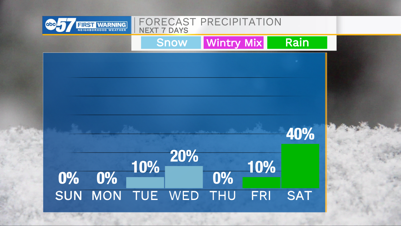
It’s another cold start to the day with temperatures in the 20s and feel like temperatures in the teens. We are tracking more sunshine on the way for today, which will help warm highs into the mid to upper 30s again this afternoon. Winds will stay persistent into the afternoon with occasional gusts reaching 20-25mph. This will keep the wind chill a few degrees cooler throughout the day. Temperatures this week will stay on a warming trend with highs hitting the mid 40s on Wednesday and then the lower 50s by Saturday. Our next best chance for showers and even a few isolated thunderstorms will arrive next Saturday.
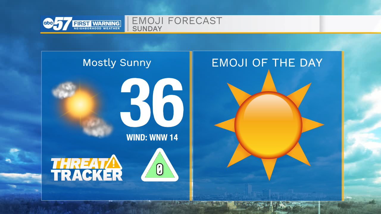
Today: Mostly sunny. High 36.
Tonight: Mostly clear. Low 20.
Tomorrow: Mostly sunny. High 40.
Tuesday: Partly cloudy. High 42.