Wet and windy night, small improvements Wednesday


Cool, wet and windy is the best way to sum up Tuesday evening. Gusts could top 30 mph but the wind will relax into the morning hours. Wet weather will also diminishes overnight into Wednesday.
The cool and gloomy weather continues Wednesday, overall the forecast is drier but lake effect rain and drizzle is still likely through the afternoon. Temperatures will struggle to warm into the upper 40s and lows dip into the mid-30s by Thursday morning. Depending on how quickly skies clear a frost is possible. The forecast is a little milder to end the week but the weekend remains cool.
Tonight: Cool and blustery with rain showers, low 38. 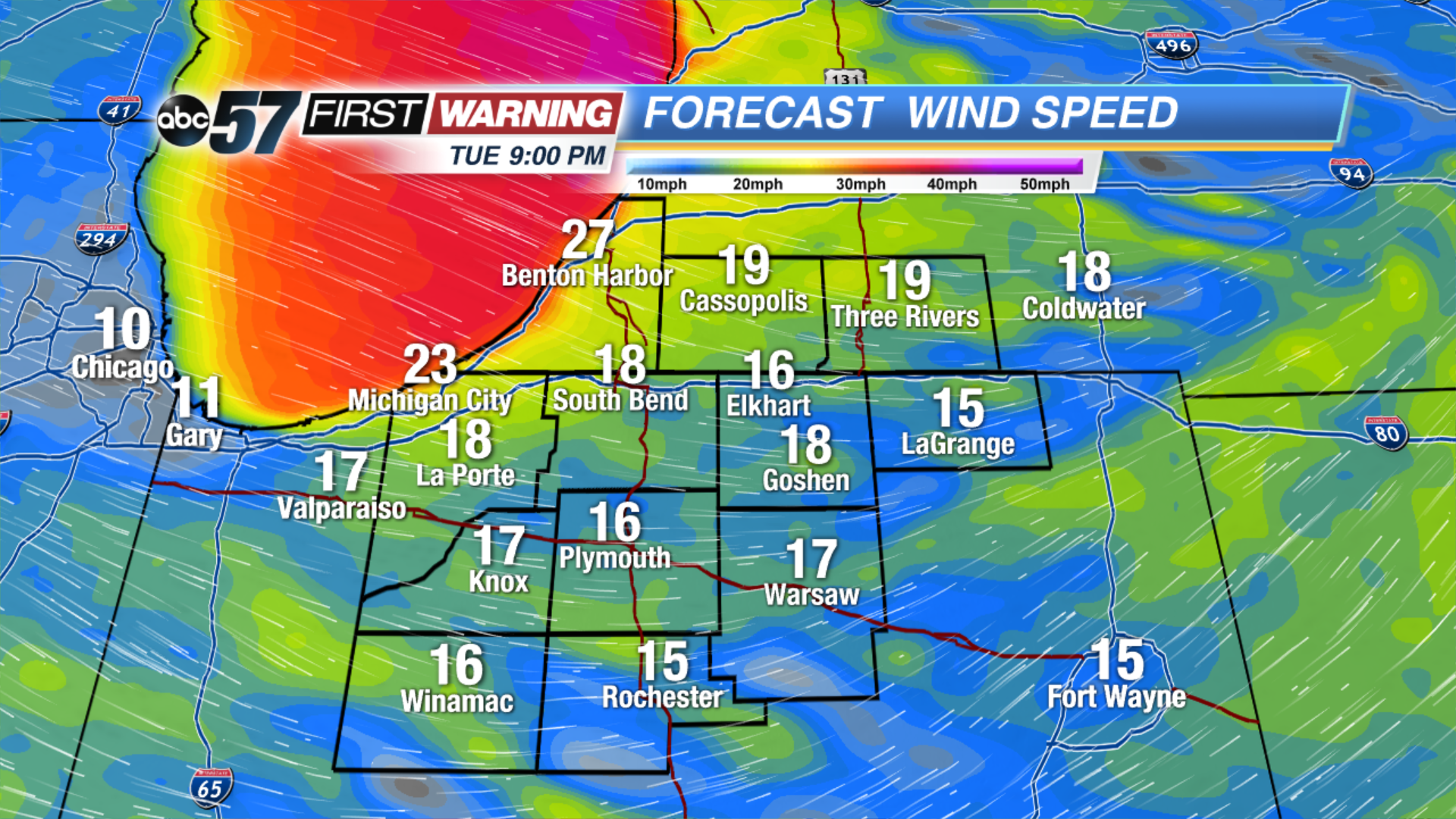 Sustained wind 15-25 mph gusts topping 30 this evening.
Wednesday: Mostly cloudy with lake effect rain, high of 48.
Thursday: Morning frost, mostly sunny, highs in the mid-50s.
Friday: Mostly cloudy, PM showers, highs in the mid-50s. 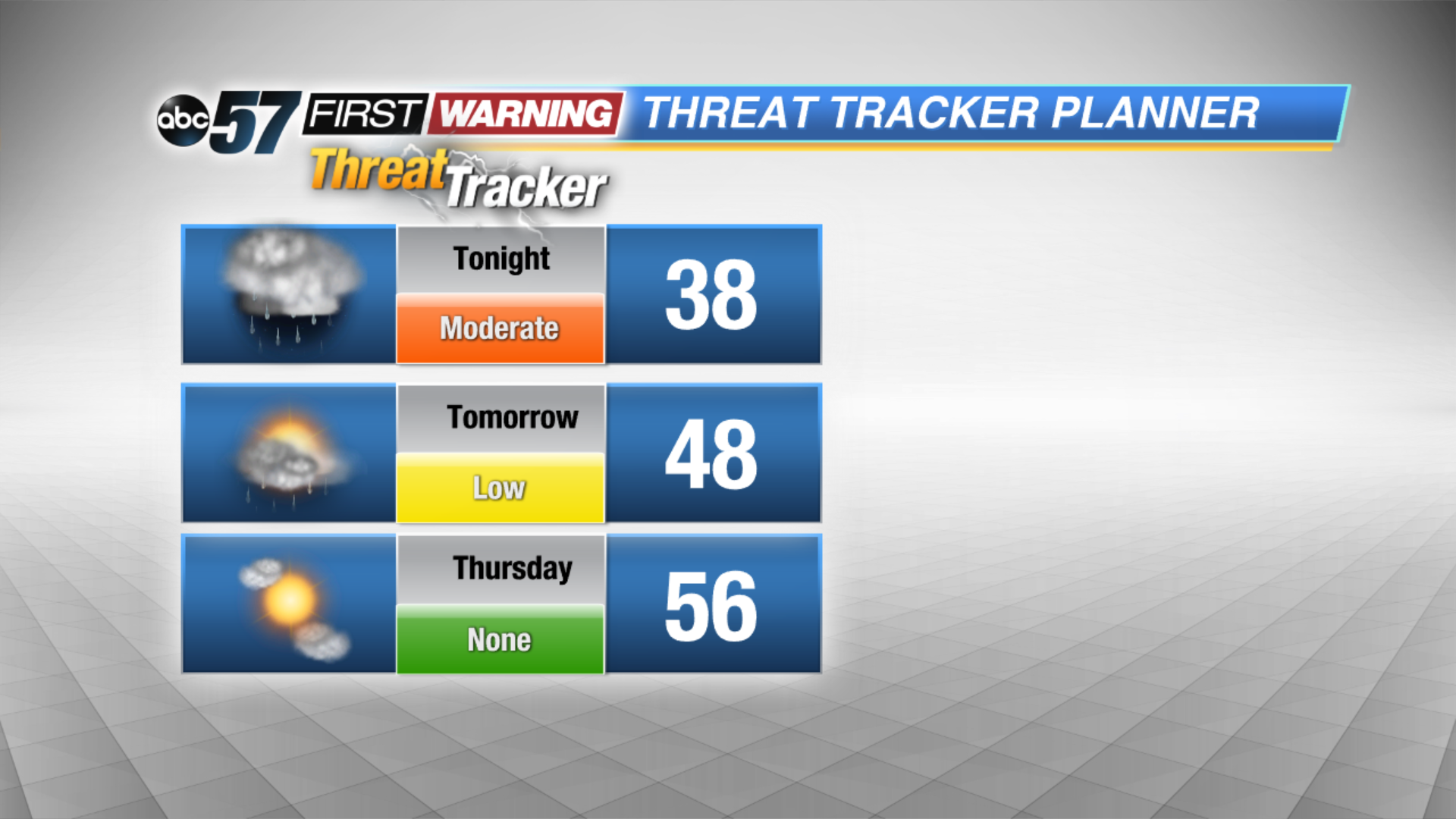 Wednesday is still gloomy but not as wet.