Wet and windy tonight, colder with a chance of snow, Friday
By:
Tom Coomes
Posted: Dec 14, 2022 5:37 PM EDT

-
2:12

South Bend City Council passes resolution urging pause on Midwest...
-
0:46

Niles City Council vote yes on putting marijuana question on...
-
0:29

Multiple Fire Departments battle residential fire in Berrien...
-
2:10

Notre Dame men’s basketball embracing urgency as Shrewsberry...
-
2:37

Local Beef-A-Roo employees still owed paychecks as private equity...
-
1:42

More storms through 8:00 p.m.
-
1:06

2nd annual Inclusive Art Fair
-
2:20

Tracking severe weather through the mid-afternoon
-
3:17

Applications open for Fall Citizens Police Academy in South Bend
-
2:23

Elkhart County 4H Fair food vendors celebrate 50th year of business
-
2:16

Young football athletes learn about protecting their bodies,...
-
1:24

Storm track timing could be shifting

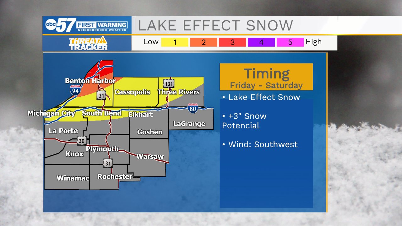
Thursday is transition day before the cold, mundane and cloudy. Friday is colder and temperatures linger near the freezing mark, trending colder through the weekend. The cold Friday night through Sunday morning will produce snow squalls and lake effect snow, but the lake effect snow is mostly directed at West Michigan and northern Berrien County. Next week is MUCH colder, and a winter storm is possible late next week, stay tuned.
Tonight: Rainy, windy. Low 36.
Thursday: Mostly cloudy. High 40.
Friday: Colder. Lake effect snow showers. High 32.
Sign up for the ABC 57 Newsletter