


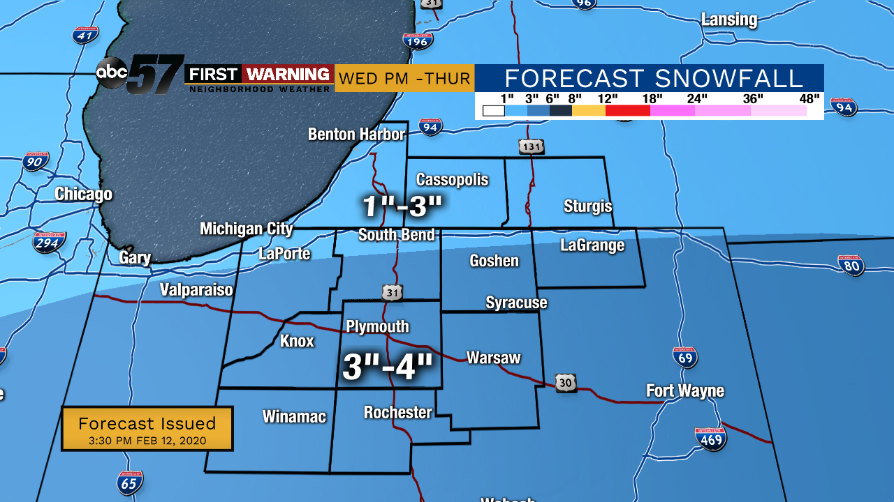
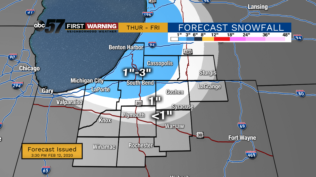
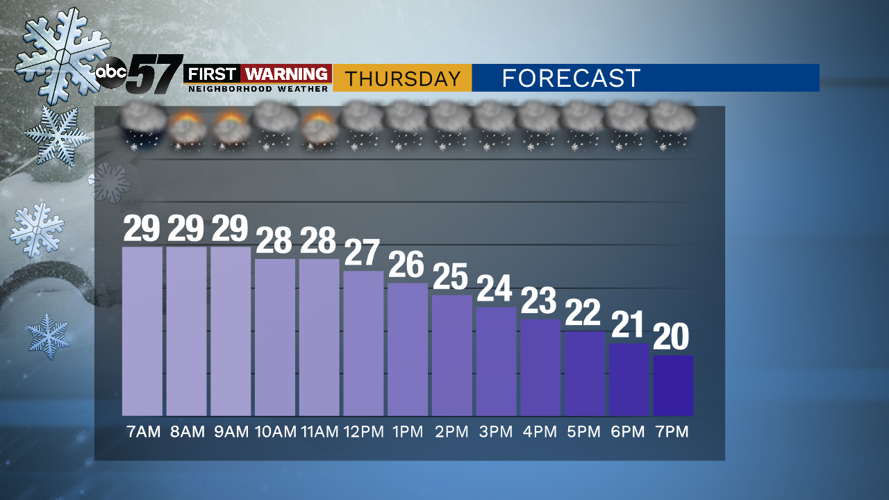
The heaviest snow will fall through midnight tonight. Snow showers continue through Thursday morning. Prepare for another slow, slick commute Thursday morning. 3-4 inches of snow is expected for most of the forecast area by Thursday morning. Thursday afternoon, an additional 1-3 inches of lake effect snow will fall in the snow belt. Temperatures Thursday start near 30, then drop significantly through the remainder of the day. Thursday night’s low is 9 degrees.
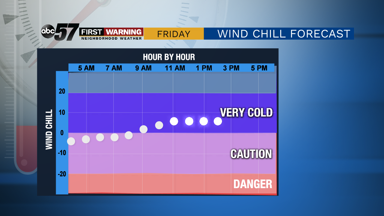
Friday will be chilly, but will be a mostly dry day. Temperatures increase for the weekend. Saturday night there is a chance for a wintry mix. Sunday is dry again, with a chance to see some afternoon sunshine.
Tonight: Snow, especially through midnight. Low 29.
Thursday: Snow showers early, then afternoon lake effect snow. Temperatures drop from 30.
Friday: A few flurries early, then partly cloudy. High 17.
Saturday: Mostly cloudy day, then evening wintry mix. High 33.