


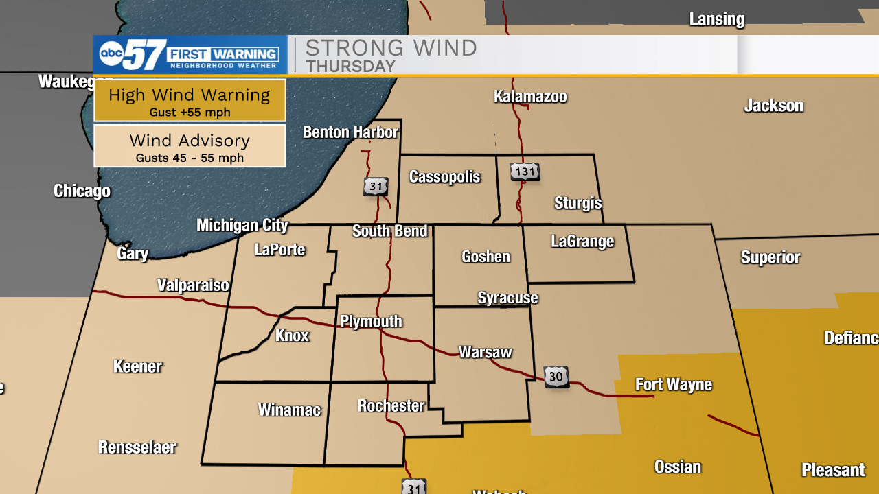
WIND ADVISORY 9 AM (EST) - 7 PM (EST) FOR ALL MICHIANA COUNTIES
Periods of moderate rain continue through the morning. You will want rain gear out the door so you don't end up soaked.
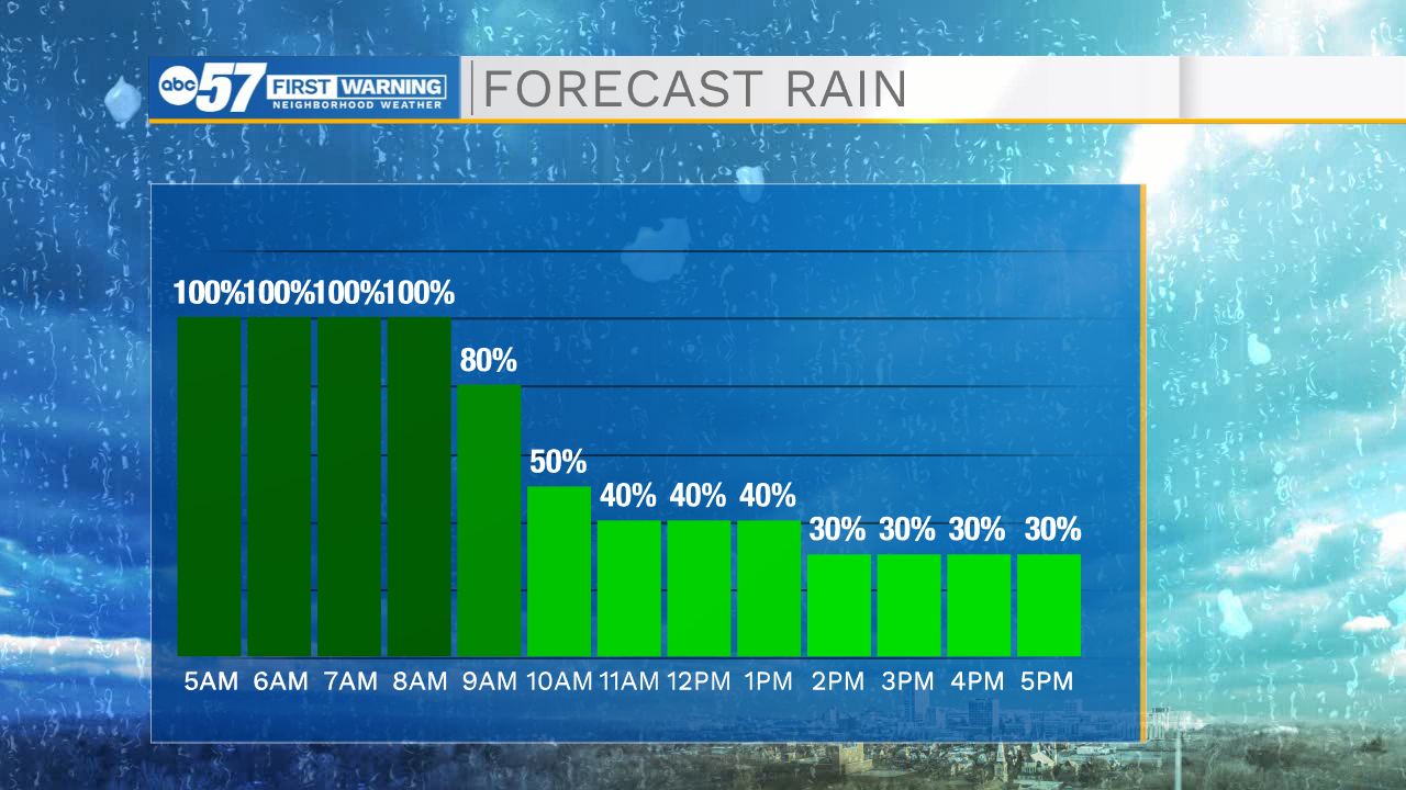
Showers are lighter by afternoon.
However, the bigger impact this afternoon is the wind. Some wind gusts 45-50 mph are possible.
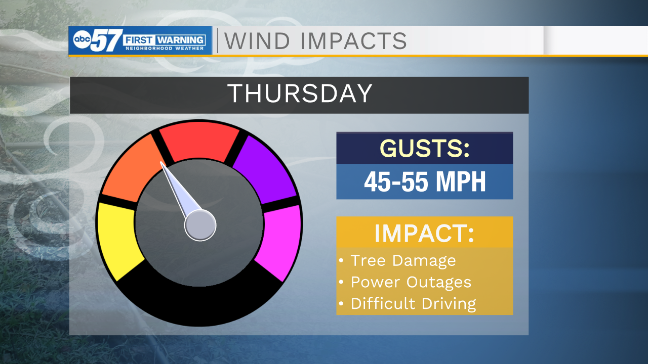
Make sure any trash cans, outdoor decorations, trampolines, are secure before you leave for work today.
Tree branches or some power lines could fall today, so scattered power outages are possible.
Make sure your phone is charged ahead of this afternoon.
Overnight, wind gusts will start to settle down. It's still a little breezy Friday and cooler with highs in the lower 30s. A few snow showers or flurries are possible tomorrow, but they have minimal impact.
Temperatures are in the 30s again Saturday but it is dry and not as breezy.
Sunday will be beautiful: sunny and highs in the upper 40s.
Next week temperatures stay above normal once again.
Another round of rain is likely Tuesday night into Wednesday.
Thursday: Rainy, windy. High 54.
Tonight: Rain early. Breezy. Low 32.
Friday: Mostly cloudy, few flurries possible. Breezy. High 34.
Saturday: Mostly sunny. High 38.