
-
2:06

Staying sunny until Thursday
-
0:58

Goshen City Council amends DORA rules amid community concerns
-
1:20

SB Common Council adopts Downtown 2045 Plan
-
2:39

Friends and family celebrate life of Jamecia Moffitt
-
1:15

St. Joseph County Council updates residents on Affordability...
-
0:51

Locals gather to recognize farmworkers across Northern Indiana
-
2:07

Impact of higher gas prices for delivery drivers
-
3:43

ND Eviction Clinic exposes ’shameful’ living conditions at...
-
3:59

Neighbors share traffic, noise concerns about proposed Capital...
-
1:50

Leaf pick up resumes in South Bend after weather postpones service...
-
1:02

Another rollercoaster ride to end the week
-
3:41

Present Pillars to host “Dad Strong 5K“ to support fathers...

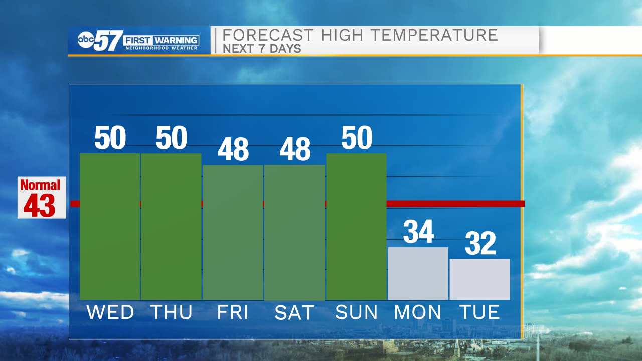
The forecast is wet through Wednesday. Temperatures continue a steady warm-up from the overnight towards 50 by Wednesday afternoon. Widespread rain is likely through midday Wednesday and tapers off by the afternoon and evening. Thanksgiving Day is dry and clouds gradually break into Friday. The forecast is fair and seasonably mild through Sunday. A cold blast drops temperatures sharply to start next week, a lake effect snow set-up for Monday and Tuesday.
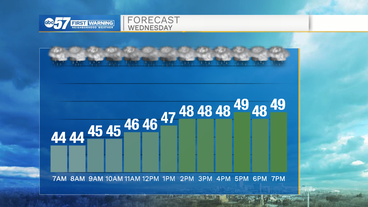
Tonight: Rain showers. Temperatures slowly warming into the low 40s.
Wednesday: Rainy. High 50.
Thanksgiving Day: Mostly cloudy. High 50.
Friday: Partly cloudy. High 48.
Sign up for the ABC 57 Newsletter