
-
1:27

Community Build underway at Kathryn Park
-
2:34

Day two of searching for a missing child continues
-
3:47

The Elkhart community is searching for answers after a 2-year-old...
-
1:04

Overall pleasant for Michiana
-
1:52

South Bend Common Council issues an official apology to residents...
-
0:54

Slightly cool out the door
-
1:54

Suspect identified, charged in fatal hit-and-run of Timothy Johnson
-
0:39

Prairie Street Cemetery works to clear storm damage
-
1:36

Reaching out for support gives father a second chance in life
-
2:08

St. Joseph County police investigating Bypass incident from Saturday...
-
2:07

Color guard coach charged with Sexual Misconduct with a Minor
-
1:09

Pleasant for the rest of today

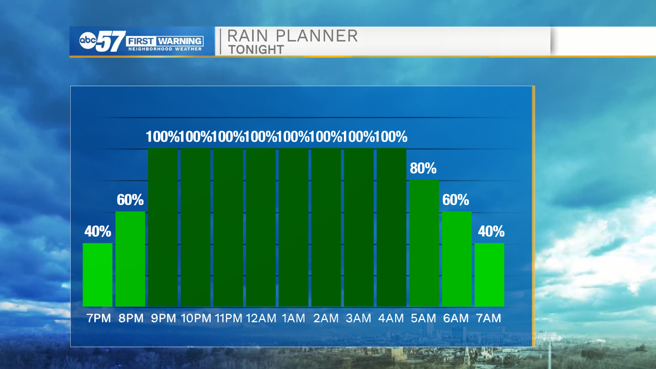
Tonight: Rain begins this evening, after 9:00 p.m. through the early morning. Wind gusts peak as the rain ends early Friday morning, near 40 mph.

Rain ends early Friday, the wind calms through the day, but it will be cool and breezy. Saturday temperatures surge near 70 ahead of another round of rain, possible thunderstorms Saturday evening. Sunday is cooler, fair weather returns and lasts through Tuesday or next week. After a chance of rain Wednesday, the forecast is clear through Easter.
Friday: Rain ending, breezy, partly cloudy. High 48.
Saturday: Afternoon/evening showers, thunder possible. High 68.
Sunday: Mostly sunny. High 50.
Sign up for the ABC 57 Newsletter