
-
1:06

Mishawaka Fieldhouse features Adidas 3Striped basketball tournament
-
2:04

Elkhart high school football players got out on the gridiron...
-
1:04

Local market event raises funds for the family of Kaylon Woods
-
2:48

Former South Bend Cub Nico Hoerner reflects on path to Chicago...
-
1:00

Medieval times return to Plym Park with the Renaissance Faire
-
2:15

South Bend celebrates Kids to Parks Day with bike-riding workshop
-
2:43

Cubs clobber White Sox in first game of ’Crosstown Classic’
-
2:00

South Bend Police Department honors the fallen
-
0:52

St. Joe/Benton Harbor Rotary holds ribbon-cutting ceremony for...
-
2:25

Irish lacrosse head to NCAA quarterfinals with Johns Hopkins...
-
3:09

Cubs, White Sox open first Crosstown Classic series of summer...
-
3:45

South Bend Cubs dedicate plaque to Indiana born composer of ’Take...

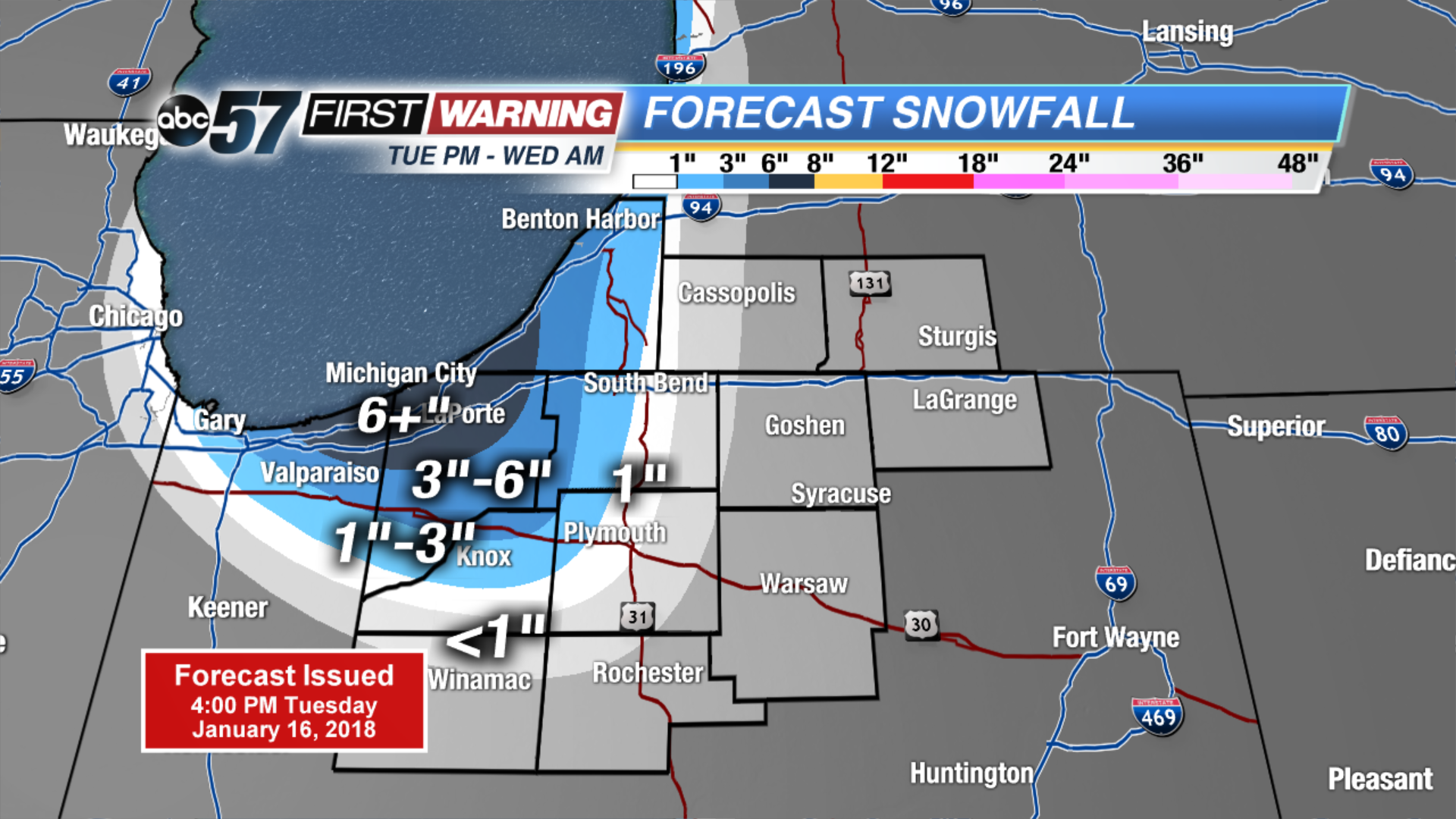
Whiteout conditions likely west of South Bend. An intense lake effect snow band Tuesday night will hamper parts of Berrien, LaPorte and Starke counties. This will be a highly localized but intense event with more than six inches of snow possible by Wednesday morning. Overnight lows will vary from around 10 degrees under the snow band to near zero under clear skies.
Light lake effect snow Wednesday morning, otherwise another cold but clearing day. The forecast is quiet the rest of the week with sunshine Thursday and Friday. We’ll have some bitter cold nights but temperatures rise into the weekend, highs will be in the 40s through Monday. The best chance of rain is Sunday into Monday.
Tonight: Lake effect snow west of South Bend, partly cloudy, lows near zero.
Wednesday: Lake effect ending, partly cloudy, high of 20.
Thursday: Mostly sunny, high of 28.
Friday: Mostly sunny, highs in the mid-30s.