Windy Wednesday, then falling temperatures and lake effect snow


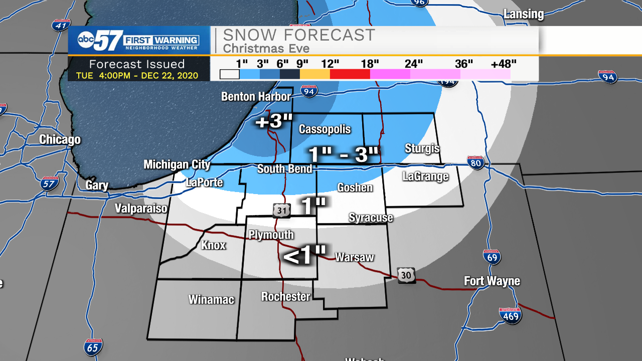
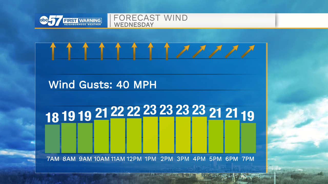
Wednesday is a mild and windy day, temperatures spike into the low 50s and the wind gusts up to 40 mph. Rain is likely Wednesday evening just before temperatures crash into Thursday. Little snow is expected from this system, as temperatures fall after most the precipitation has passed. Thursday is just a cold day, with temperatures falling into the teens by the evening. The setup for lake effect is Christmas Eve into the early morning. The snow window is relatively short and the wind setup is not the most favorable. Lake effect snow accumulation is most likely in extreme Northern Indiana and in Southwest Michigan. Up to three inches is the most likely amount in the snow belt. Christmas is cold but temperatures rise above freezing this weekend.
Tonight: Mostly cloudy. Low 36.
Wednesday: Mostly cloudy, windy, evening rain. High 52.
Thursday: Cold. Lake effect begins in the evening High 24.
Christmas Day: Morning snow showers. Cold. High 22.