


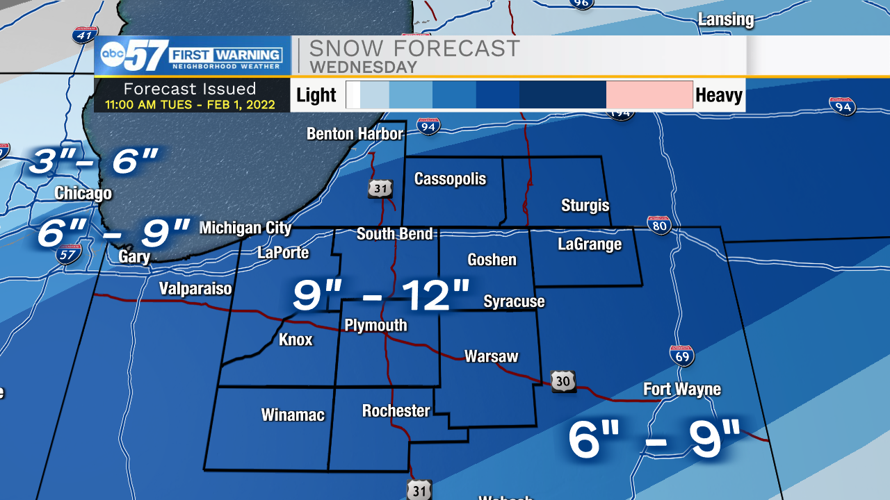
An impactful winter storm will dump upwards of a foot of snow across the area Wednesday, with some additional snow Thursday and wind that will cause drifting.
- Snowfall will near 6" in the WED morning
- Snowfall will near 9" by WED midday
- Snowfall will near 12" by WED evening
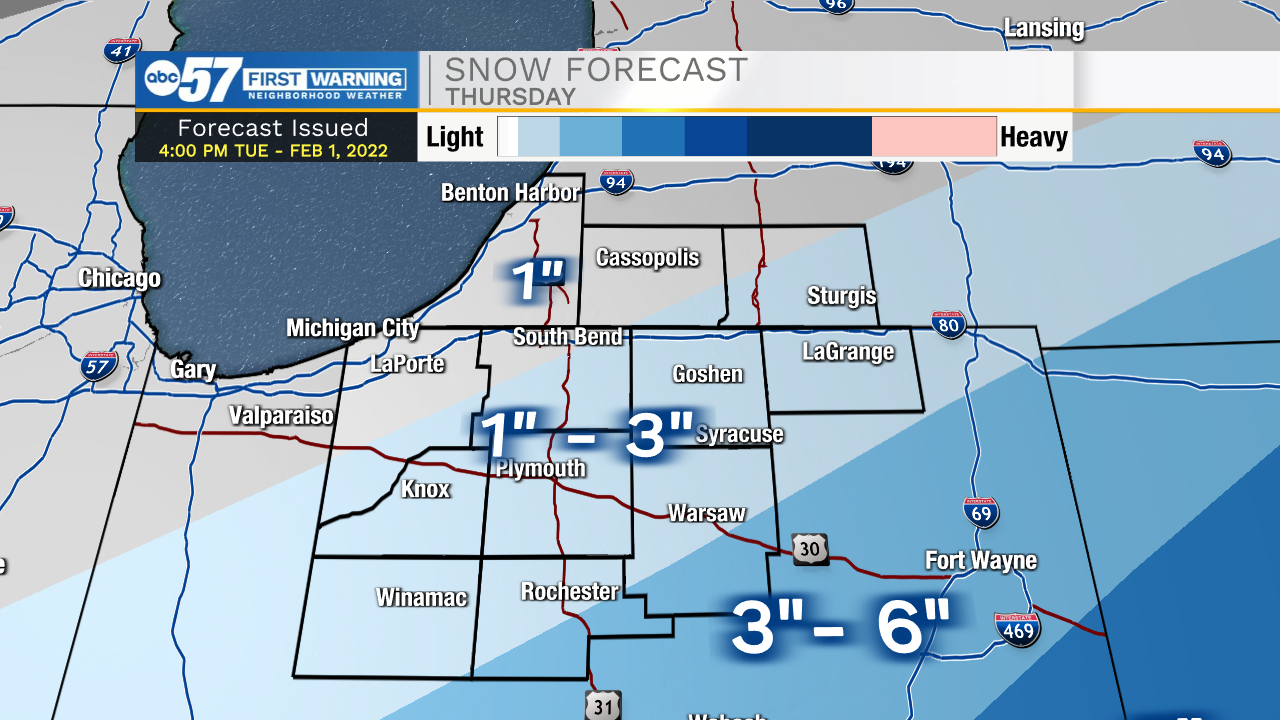
There is a lull Wednesday evening before snow resurges Thursday morning. The latest trend though is a quicker exit, where much of the area may see little additional snowfall Thursday. The exception being Kosciusko county and points southeast.
- Lighter snowfall Thursday, ending midday to afternoon.
- Wind gust up to 35 mph Thursday midday
- Blowing and drifting snow a problem on rural roads.
The end of the week is bitter cold, highs struggle to reach 20, lows near zero and the wind chill be will subzero Friday and Saturday.
Tonight: Rain turns to snow. Slick roads possible, snowy morning Low 30.
Wednesday: Snow, all day. High 32.
Thursday: Snow & blowing snow. High 20.
Friday: Mostly sunny. High 18