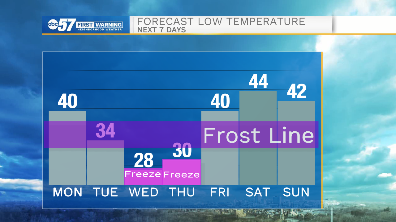
Wintry mix and cold temperatures on the way for this week


Tonight, cloud cover will increase slightly helping to keep temperatures tomorrow morning in the upper 30s to lower 40s. Tomorrow afternoon high temperatures will top out in the lower 60s under mostly sunny skies. Rain chances return tomorrow afternoon, primarily in our northern Michiana counties. As we head into Tuesday morning some of that rain will turn over to a wintry mix as temperatures drop closer to freezing. Wintry mix and snow showers will remain in our forecast till Wednesday morning, with a few small chances for some flurries Wednesday afternoon. 1-3 inches of snow are possible for most of Michiana. Slick spots are likely on bridges and overpasses, especially as temperatures fall well below freezing into Wednesday morning. Lows to start your Wednesday will be in the mid to upper 20s. The fruit crop that is near or at bloom now could be greatly impacted with the cold temperatures Wednesday morning.
Tonight: Partly cloudy. Low 40.
Tomorrow: Mostly sunny. High 60.
Tuesday: Wintry mix. High 39.
Wednesday: AM Snow. High 40.