


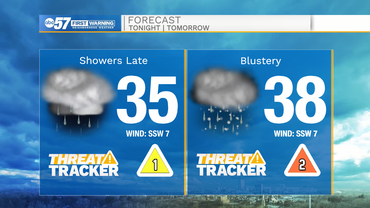
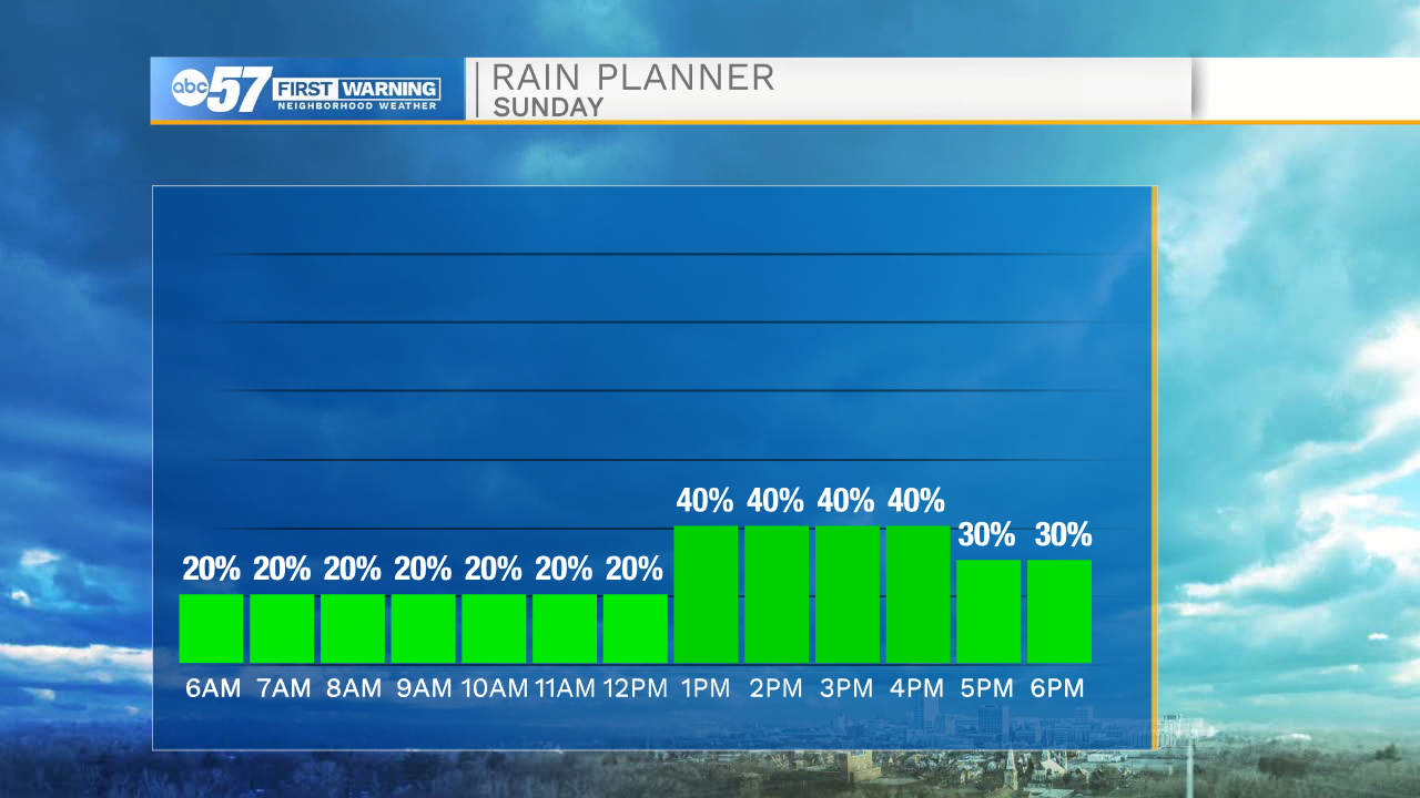
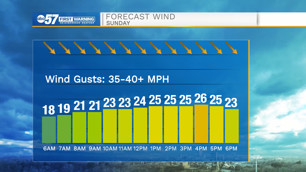
A cold front will move into Michiana during the overnight hours. This front will produce a few isolated showers and some possible wintry mix. We are also tracking very strong winds behind the front as well. Wind speeds tomorrow will range from 25-35mph with gusts into the 40s. More showers and wintry mix are possible tomorrow afternoon and evening. Temperatures will only top out in the upper 30s.
Monday morning will be another cold one with temperatures in the upper 20s. Sunshine returns Monday afternoon, and looks to stick around throughout most of next week. Temperatures next week will warm into the upper 50s by Tuesday, and the mid 60s Wednesday. Dry weather and warmer temperatures will stick around through next weekend.
Tonight: Showers/wintry mix. Low 35.
Tomorrow: Windy/wintry mix. High 38.
Monday: Mostly sunny. High 48.
Tuesday: Sunny. High 58.