
-
1:57

A local taste brings New Carlisle community together on race...
-
0:45

Pancakes help raise funds to support the Alzheimer’s Association
-
1:03

Lighter rain expected into the afternoon
-
1:04

Non-severe storms expected
-
1:16

Showers start this morning
-
1:59

Mac & Cheese festival turns Four Winds Field into a kitchen
-
0:45

Michiana Spring Clay tour encourages people to try and take a...
-
2:56

Fresh Cuts, Fresh Starts: Re-Entry Program Gives Back in Elkhart
-
0:53

Jr. Irish Memorial Day invitational celebrates veterans and active-duty...
-
1:15

Another rain chance this holiday weekend
-
0:46

Holiday weekend starts rainy
-
1:13

South Bend West Side Memorial Day Parade Preview

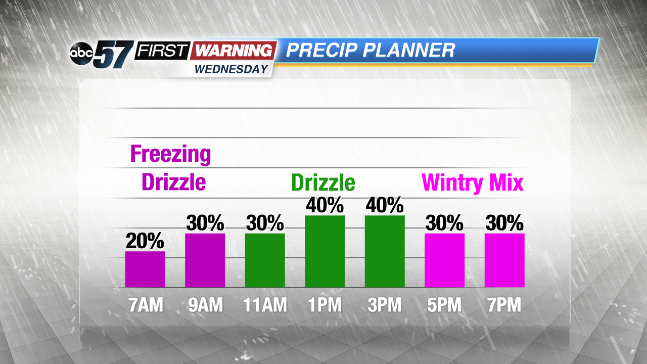
There’s a chance of light precipitation Wednesday, what actually falls will come down to changing temperatures through the day. Freezing drizzle is possible mid-morning, changing to just rain as temps rise above freezing midday and then a rain/snow mix when temps drop again in the evening. Overall impacts will be low but slick spots are possible.
High temperatures stay in the 40s through the weekend with rain likely Friday. The extended forecast is pretty mundane for mid-December.
Tonight: Increasing clouds, low of 26.
Wednesday: Cloudy, chance of rain/snow showers, high of 38.
Thursday: Mostly cloudy, high of 42.
Friday: Rain showers, high of 42.
Sign up for the ABC 57 Newsletter