How the tornado, funnel cloud formed over Marshall County, South Bend


See Also
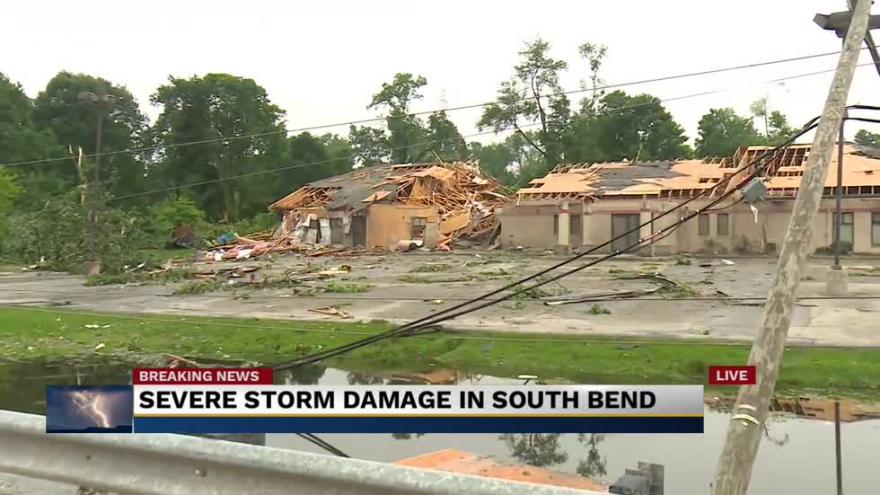
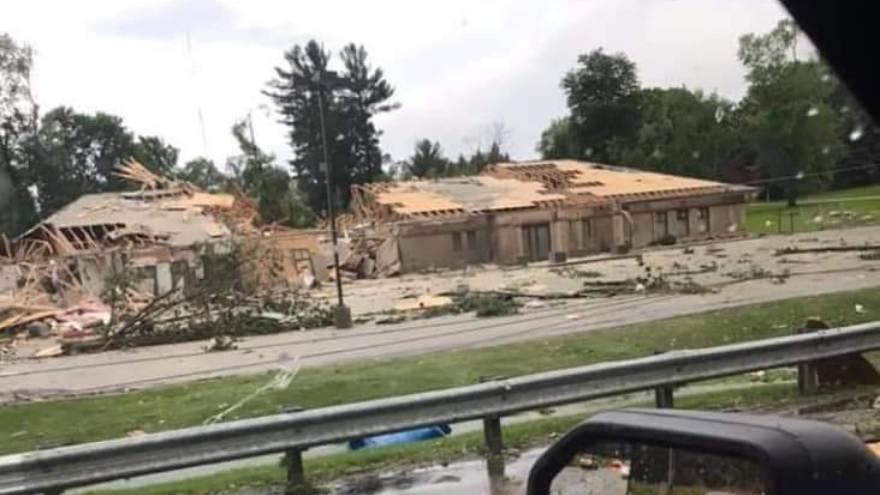
SOUTH BEND, Ind.—On Sunday night, a weak funnel cloud and tornado formed over northern Marshall County before moving on to the southeast side of South Bend.
Once in South Bend, the formation brought down trees and power lines and caused damage to homes and businesses in the area.
How did this reported tornado form?
A weak warm front was sliding through Michiana, helping showers and a few rumbles of thunder stay together through the evening.
Extra storm energy was still placed over the central portions of the area, keeping the unstable environment in place.
The wind shear on Sunday night was unique; light surface wind coming off of the lake interacted with a southerly wind higher up in the atmosphere.
The wind shear, or the turning of the wind with height, provided the spin needed to produce the weak spin-up seen on Sunday.
After moving just north of the bypass, the funnel lifted and the tornado warning was cancelled.
SOUTH BEND TORNADO:
— Tyler Sebree (@TylerABC57) June 24, 2019
An incredible view of the large tornado from Irish Hills Apartments. The NWS has given the tornado a preliminary rating of EF-2 with winds of 115-125 MPH, a path length of 2 miles and a total duration of 10 mins.
?: Sunshine Daye Allen#INwx#Tornadopic.twitter.com/9pmW9msQBY