
-
2:00

Annual Studebaker car show takes over Ironwood Plaza
-
0:55

Beautiful weekend expected
-
1:05

Truly wonderful conditions
-
0:41

One person left with serious injuries after high-speed pursuit...
-
2:15

Fort Wayne Tin Caps put an end to the SB Cubs winning streak
-
1:21

This weekend is the annual Hall of Heroes Comic Con
-
0:46

Elkhart Police Department respond to shots fired call at the...
-
3:55

ABC57 speaks with Cass County Commissioners, Judge and Interim...
-
2:48

Common Council to consider appeal options following South Bend...
-
0:52

South Bend seniors explore local parks, event centers, and available...
-
1:51

Mentone Egg Fest celebrates 80th year
-
4:58

New reactions after Notre Dame releases findings of priest sex...

A burst of snow Friday morning between 4:00 a.m. and noon will bring a widespread three inches of snow to much of Michiana, with localized higher amounts between Plymouth and Fort Wayne. This wet spring snow will be at it's heaviest around 8:00 a.m. and then transition to a rain/snow mix after 10:00 a.m. The snow will mostly accumulate on grass and bare ground but roads may also be coated for a shorter period of time. Snow gradually melts through Friday afternoon. The weekend is fair and milder in the mid to lower 50s.
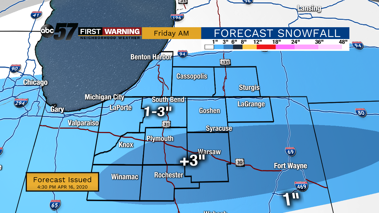
Tonight: Snow showers late. Low 30.
Friday: AM snow/mix, mostly cloudy. High 40.
Saturday: Mostly sunny. High of 52.
Sunday: Partly cloudy. High of 50.
Sign up for the ABC 57 Newsletter