


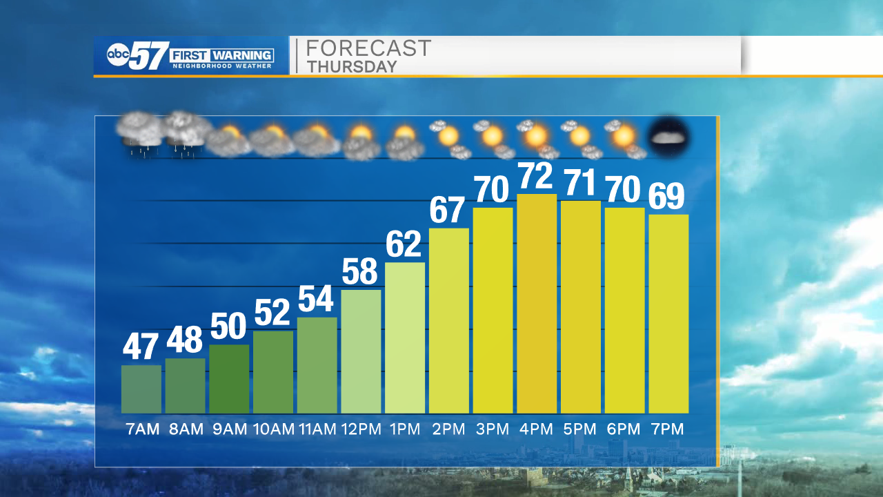
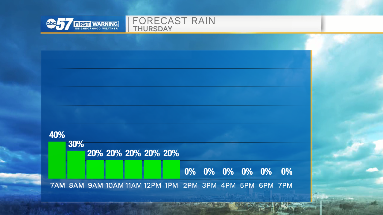
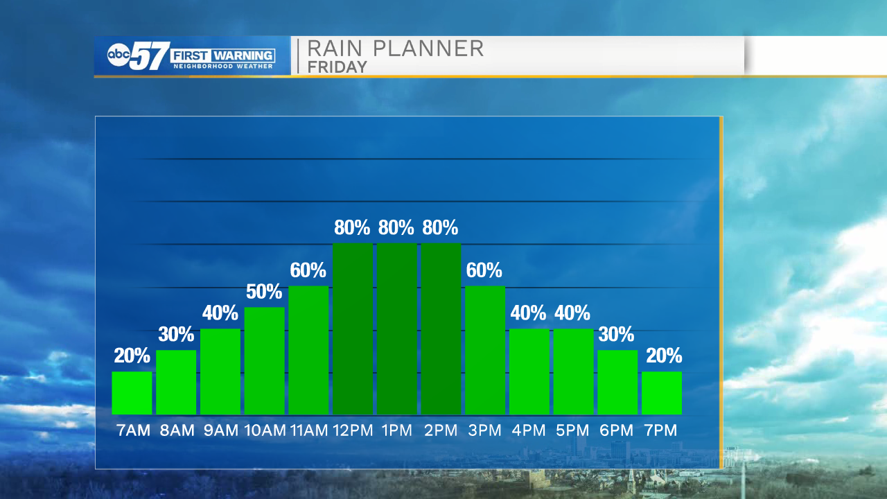
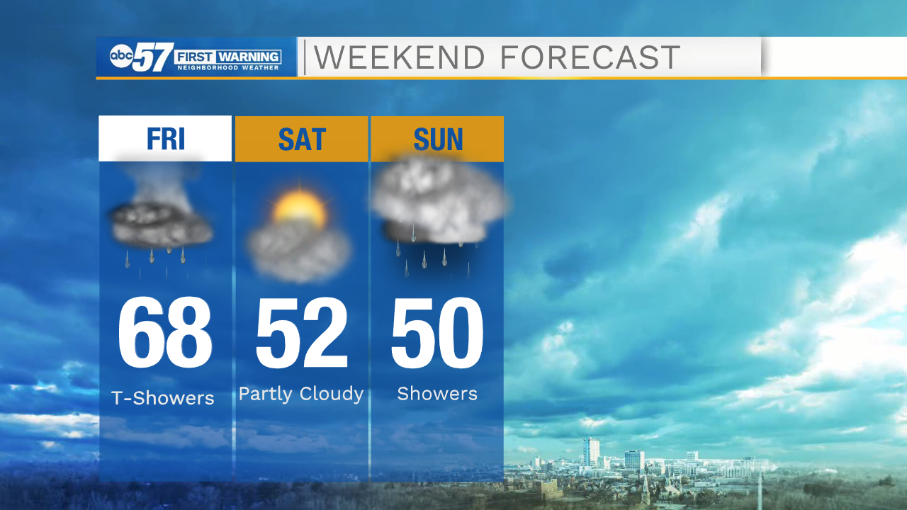
A warm front will slowly work northward this morning taking the rain showers along with it. This afternoon mostly sunny skies are expected with highs hitting the lower 70s. A cold front will move in tomorrow by late morning and bring a line of showers and thunderstorms. Storm activity looks to remain on the weaker side. After the cold front clears, strong winds will stick around through the afternoon and evening. This weekend more rain activity is likely and temperatures only look to top out in the lower 50s.
Early next week more scattered showers are possible, and temperatures will keep falling into the upper 40s by Tuesday afternoon. Highs throughout the rest of the week will only make it back to the lower 50s.
Today: Partly cloudy/mostly sunny. High 72.
Tonight: Partly cloudy. Low 63.
Tomorrow: Scattered showers and storms. High 68.
Saturday: Mostly to partly cloudy. High 52.