Another powerful fall storm to bring rain, storms, strong wind gusts, and large waves
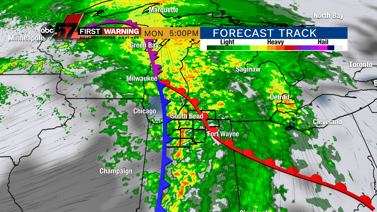
After a gorgeous fall weekend, another powerful fall storm system is set to impact the Midwest, Great Lakes and Ohio Valley Monday into Tuesday.
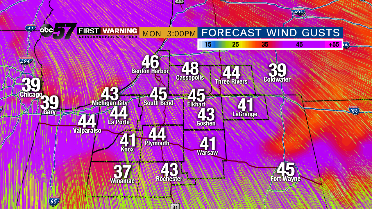 Potential wind gusts Monday afternoon.
Even without thunderstorms, wind gusts could reach 35-45 mph on Monday.
Another fall storm possible on Lake Michigan Monday night - Tuesday night. Large waves to bring another round of beach/dune erosion. #wmiwx pic.twitter.com/ihqy4aNcwM
— NWS Grand Rapids (@NWSGrandRapids) October 20, 2019
Also of importance will be what the strong winds do to Lake Michigan. After experiencing one of the worst storms in years last Wednesday, lakeshore communities are once again set to see strong winds and large waves on Tuesday as the wind direction shifts.
The worst of the waves will be north of South Haven into West Central Michigan on Tuesday. That includes locations such as Saugatuck, Holland, Grand Haven, and Muskegon.
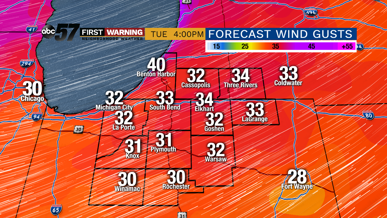 Possible wind gusts Tuesday afternoon.
This could lead to addition beach and dune erosion, submerged piers and perhaps minor lakeshore flooding.
It will once again be breezy on Wednesday, but waves will drop below five feet.
