Cloudy Friday evening; warm and cloudy weekend ahead
![](/images/abclogo_gray.png?x)
-
2:30
Mishawaka ‘Designated Outdoor Refreshment Area’ along riverwalk...
-
0:50
Saint Mary’s College breaks ground on Heritage and Research...
-
6:13
Rep. Rudy Yakym discusses Netanyahu’s address to Congress and...
-
3:41
Three civil rights lawsuits filed against Elkhart Police
-
1:03
The humidity returns, Sunday
-
1:57
Why the dew point is the best way to represent humidity
-
4:18
What is Project 2025 and why does it matter?
-
0:45
The South Bend Police Department hosts inaugural community track...
-
1:10
’A Rosie Place’ in South Bend welcomes new equine friend
-
1:42
Thanks to the weather, Michiana corn seeing rapid growth
-
4:10
Developing Downtowns: South Bend
-
2:25
After closure in 2020, YMCA reopens in downtown
Light scattered showers are possible throughout the afternoon, but conditions will remain mainly dry with mostly cloudy skies. Clouds with be decreasing throughout the day, with skies being partly cloudy overnight. Low’s overnight will drop into the mid-50’s. Saturday will bring partly sunny skies with high temperatures climbing into the upper 70’s. Another chance for rain comes Saturday night into Sunday morning, with a few thunderstorms being likely as well. Clouds will decrease throughout the day, giving way to partly sunny skies during the afternoon hours. Next week will feel a lot more like summer with hot temperatures reaching into the 90’s and mostly sunny skies throughout the week.
![](https://newscdn2.weigelbroadcasting.com/60LmP-1654899012-embed-Weekend%20Forecast%20SAT-MON.png)
Today: Slight chance of scattered afternoon showers. High of 76.
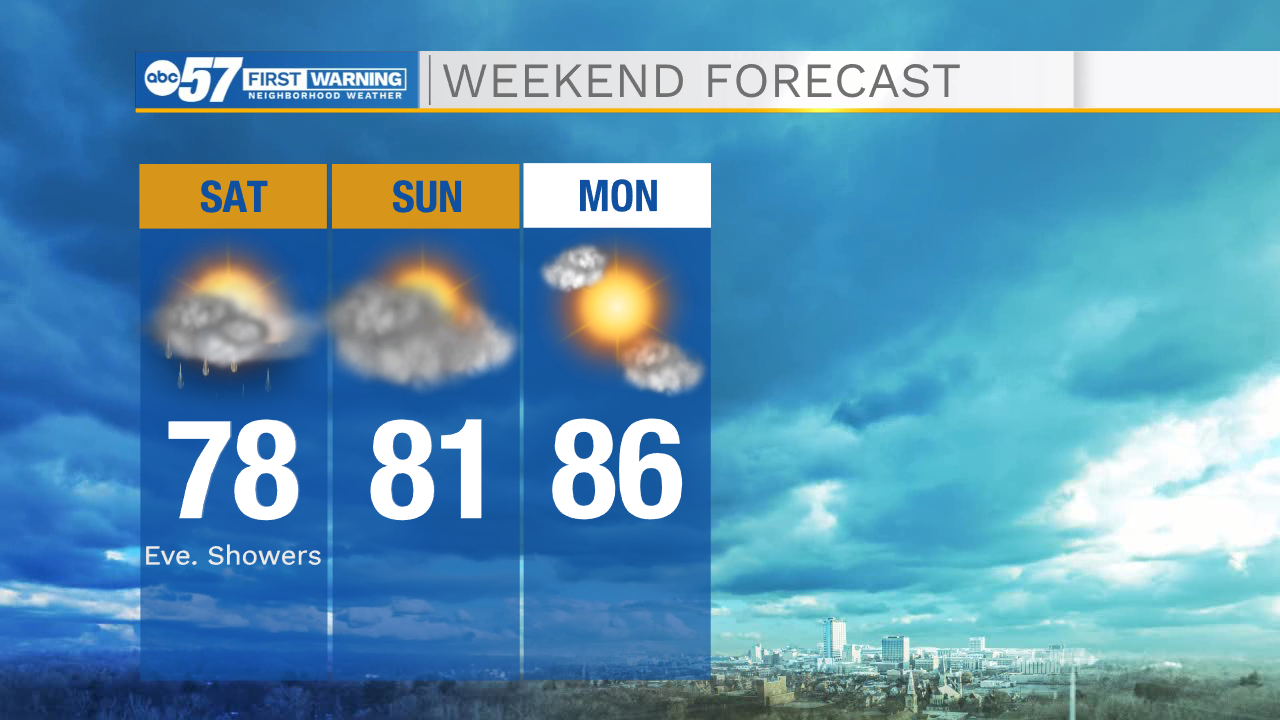
Tonight: Partly cloudy. Low of 55.
Saturday: Partly sunny becoming partly cloudy. High of 78.
Sunday: AM showers, then partly sunny. High of 81.
![](https://newscdn2.weigelbroadcasting.com/D5Uaz-1654899081-embed-Heat%20Index%20Forecast%20TOMORROW-%205%20Day.png)