Cold and snowy New Year's Weekend


Cold and snowy through the New Year’s weekend, especially in the lake effect zones. A clipper system will bring widespread snowfall Friday night through Saturday of at least one to three inches, with higher totals near the lake.
This weekend’s snowfall will primarily be a lake effect event. Additional lake effect snowfall Saturday through Monday morning will likely bring at least three to six inches of snow with two-day totals of more than a foot through parts of Berrien county. Keep in mind not all this snow will come at once but accumulate steadily with lake effect bands through the entire weekend.
Bitter cold will also worsen the harsh winter weather, along with breezy conditions that could make for treacherous travel. Temperatures will fall from Saturday through early next week. With highs in the single digits and lows subzero.
Tonight: Light snow, cloudy, low 10. 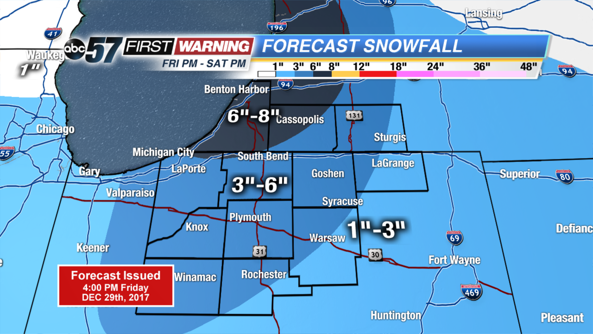 Cold and snowy through the New Yearâs weekend, especially in the lake effect zones. A clipper system will bring widespread snowfall Friday night through Saturday of at least one to three inches, with higher totals near the lake. This weekendâs snowfall will primarily be a lake effect event. Additional lake effect snowfall Saturday through Monday morning will likely bring at least three to six inches of snow with two-day totals of more than a foot through parts of Berrien county. Keep in mind not all this snow will come at once but accumulate steadily with lake effect bands through the entire weekend. Bitter cold will also worsen the harsh winter weather, along with breezy conditions that could make for treacherous travel. Temperatures will fall from Saturday through early next week. With highs in the single digits and lows subzero. Tonight: Light snow, cloudy, low 10.Saturday: Lake effect snow, high of 14. Sunday: Effect snow, high of 8. New Yearâs Day: Partly cloudy, highs near 10
Saturday: Lake effect snow, high of 14.
Sunday: Effect snow, high of 8.
New Year’s Day: Partly cloudy, highs near 10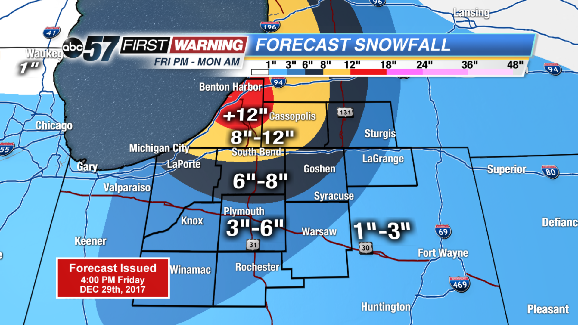 Grand total snowfall Friday through Monday morning
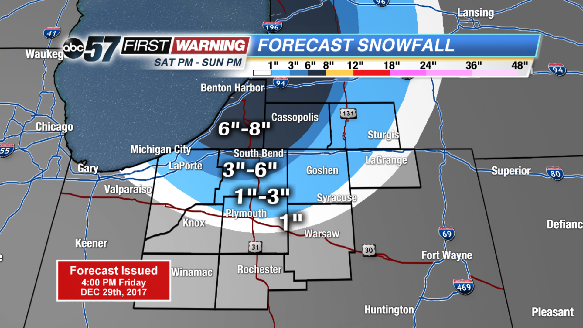 Lake effect snow Saturday night through Sunday