
-
1:14

Widespread showers and downpours this morning ahead of warm front
-
1:48

Preparations underway as Indiana University football trophies...
-
3:09

Indiana Utility Regulatory Commission collecting consumer data...
-
1:18

St. Joseph County officials host Election 101 Workshop on voting...
-
5:36

Hannah Hidalgo wins Naismith Defensive Player of the Year
-
2:50

New South Bend Cubs manager Daniel Wasinger ready for opening...
-
2:24

South Bend Cubs pitcher Kenten Egbert looks to build on strong...
-
1:52

Hoosiers face a gas tax increase as gas prices continue to rise
-
1:45

Iranian cybercrime group claims to have hacked St. Joseph County’s...
-
1:17

Cold and soaking rain today, another severe risk tomorrow
-
0:44

South Bend High School Music Festival highlights student talent
-
1:55

South Bend house fire possibly caused by lightning

Lake effect snow showers continue Monday night as temperatures fall through the 20s. Lake effect zones could pick up an additional one to three inches through Tuesday evening.
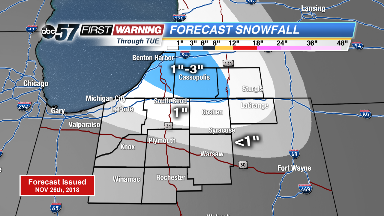
Cold and snowy Tuesday. Temperatures will stay in the 20s and light snow showers continue off of Lake Michigan. Temperatures fall into the teens Tuesday night . Temperatures start to rise to end the week with a chance of wintry mix Thursday and rain Saturday with the next thaw.
Tonight: Lake effect snow showers, cloudy, low of 22.
Tuesday: Mostly cloudy, lake effect snow showers possible, high of 26.
Wednesday: AM flurries, mostly to partly cloudy, high of 28.
Thursday: Cloudy, wintry mix possible, high of 34.
Sign up for the ABC 57 Newsletter