


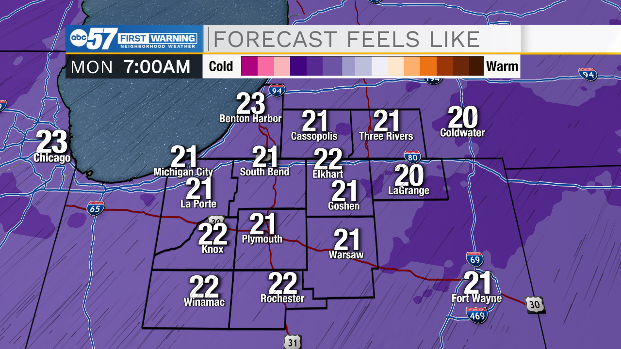
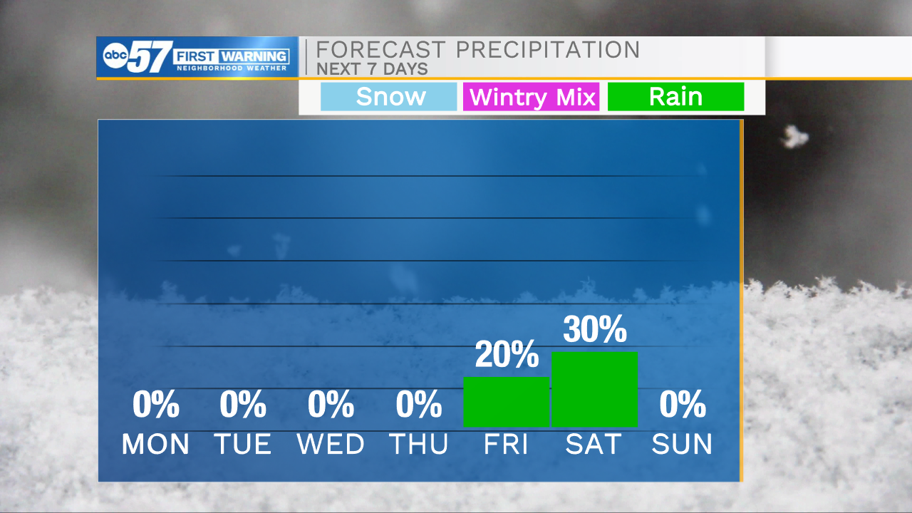
The cold and cloudy conditions will stick around through tomorrow morning. Temperatures to start your Monday will be in the mid 20s with feel like temperatures closer to the teens. We will see cloud cover clear and sunshine return by the afternoon. Highs tomorrow afternoon will be in the lower 40s. Dry weather will settling in for most of the week with high temperatures staying in the upper 30s to lower 40s through Thursday. We will see a brief warm up on Christmas Eve and Day with highs reaching into the mid 40s. Isolated rain chances arrive late Christmas Eve and turn scattered into Christmas Day. Our next potential winter weather maker could arrive into early that following week.
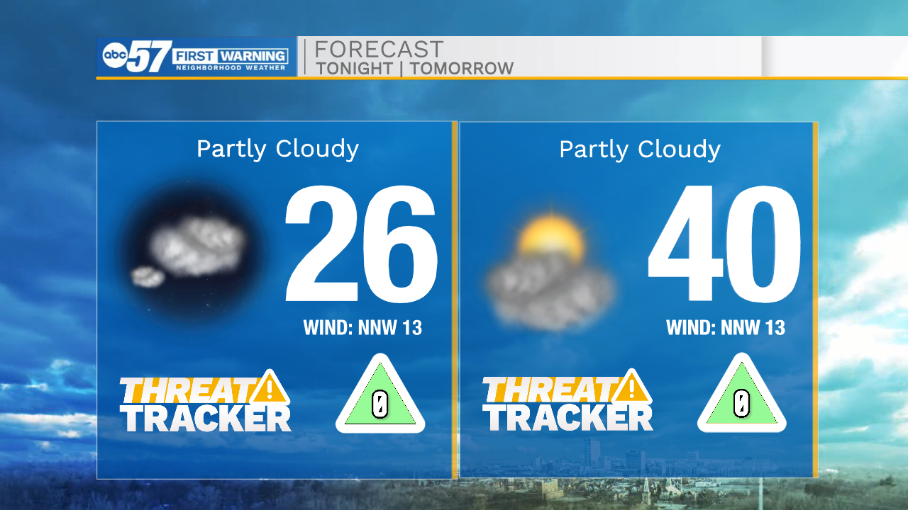
Tonight: Mostly cloudy. Low 26.
Tomorrow: Partly cloudy. High 40.
Tuesday: Mostly sunny. High 40.
Wednesday: Partly cloudy. High 36.