
-
1:57

A local taste brings New Carlisle community together on race...
-
0:45

Pancakes help raise funds to support the Alzheimer’s Association
-
1:03

Lighter rain expected into the afternoon
-
1:04

Non-severe storms expected
-
1:16

Showers start this morning
-
1:59

Mac & Cheese festival turns Four Winds Field into a kitchen
-
0:45

Michiana Spring Clay tour encourages people to try and take a...
-
2:56

Fresh Cuts, Fresh Starts: Re-Entry Program Gives Back in Elkhart
-
0:53

Jr. Irish Memorial Day invitational celebrates veterans and active-duty...
-
1:15

Another rain chance this holiday weekend
-
0:46

Holiday weekend starts rainy
-
1:13

South Bend West Side Memorial Day Parade Preview

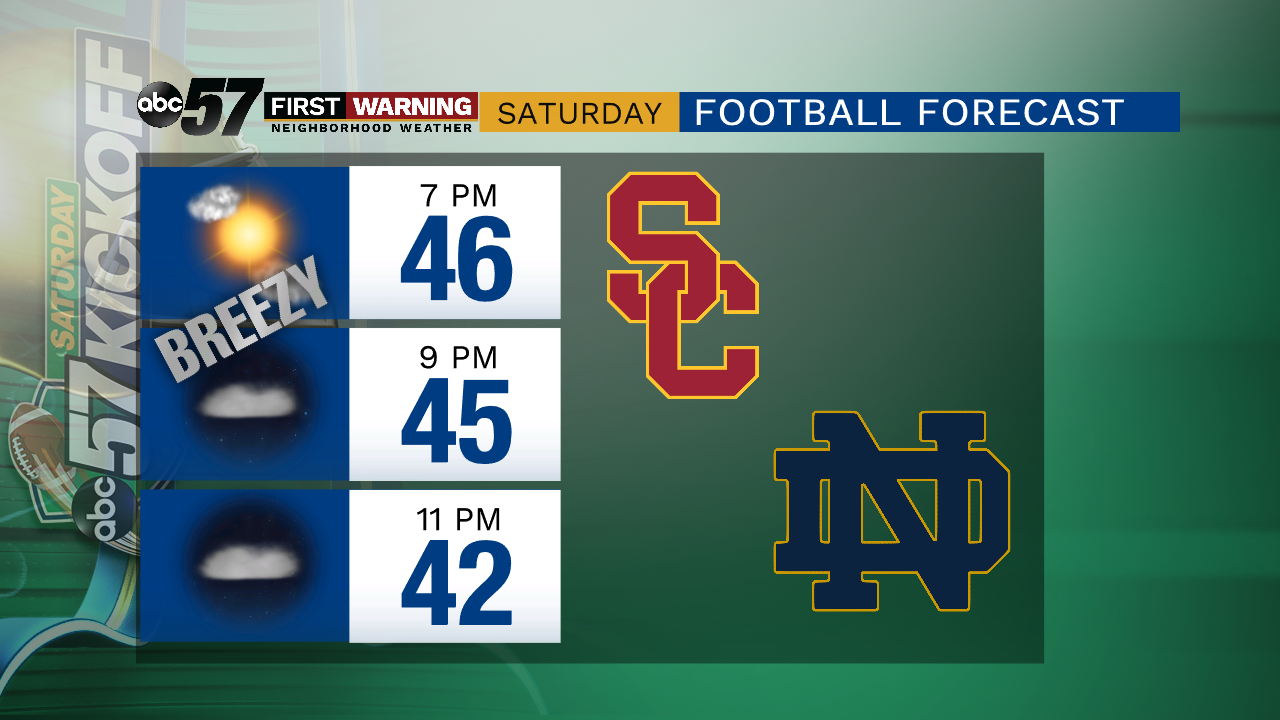
The first effects of the fall storm begin early Friday with rain showers and rain is likely much of the day. Temperatures peak near 70 at noon and fall steadily after the cold front passes around 2:00 p.m. dropping to the 40s by the evening. Wind gusts range 25 to 30 mph and it stays breezy through much of Saturday. Skies clear for the weekend but temperatures remain cool, highs only in the low to mid 50s.
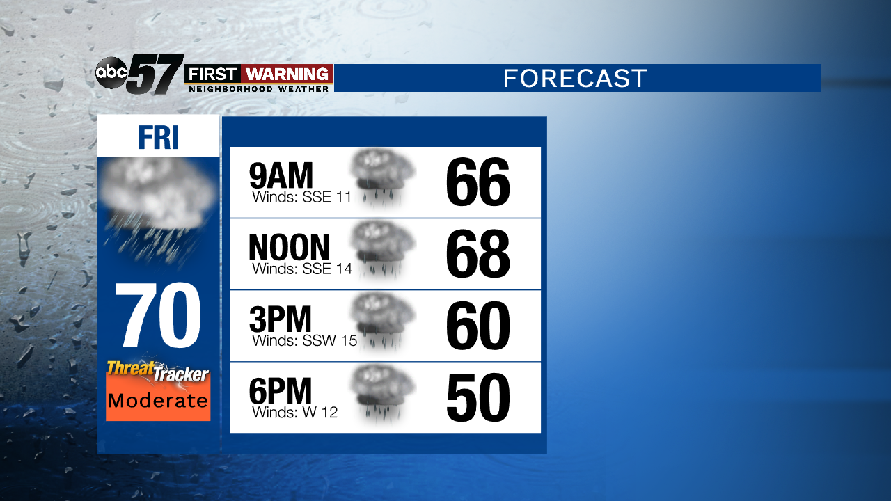
Tonight: Shower by morning. Low of 63.
Friday: Rainy and breezy. High of 70.
Saturday: Fair and breezy. High of 50.
Sunday: Sunny. High of 56.
Monday: Sunny. High 56.
Sign up for the ABC 57 Newsletter