Few snow showers Sunday ahead of main snow event Monday


There are a few light snow showers today, but the main event of our forecast is the winter weather Monday night into Tuesday morning.
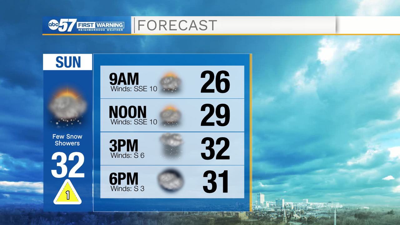
Today will be mostly cloudy with a few showers or flurries. There is also a possibility of a brief freezing drizzle, but overall impacts today are low with little to no accumulation. Tonight should also stay quiet with temperatures falling into the mid 20s.
Monday morning's commute shouldn't have many impacts. Precipitation holds off until Monday afternoon. Snow showers, sleet, or a wintry mix start in our southern counties first, then gradually move to the north through the evening.
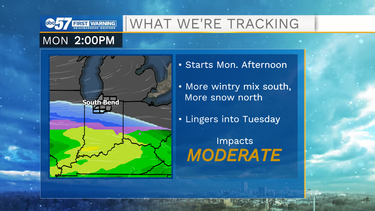
The heaviest snow showers are Monday overnight into early Tuesday.

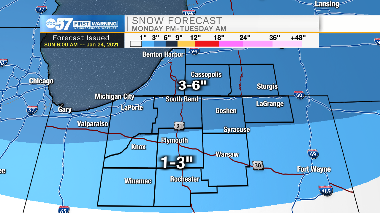
Any Monday night or Tuesday morning travel will likely be slow with reduced visibility and slick spots, as well as accumulating snow. Our southern counties will end with more wintry mix and possibly some freezing rain. Southern Michiana will have lower snow totals, around 1-3” possible. Our northern counties will pick up more snow and less ice, with 4-6” of snow possible by Tuesday afternoon.
There is a possibility for a few more snow showers Wednesday night into early Thursday, but Thursday and Friday will be quiet pleasant days with a chance to see a mix of clouds and sunshine in the sky.
Today: Mostly cloudy. Few snow showers/flurries. High 32.
Tonight: Mostly cloudy. Few flurries possible. Low 26.
Monday: PM snow. Windy. High 32.
Tuesday: AM snow. Breezy. High 32.